- Usage in publication:
-
- Healing Springs sandstone member*
- Modifications:
-
- Named
- Dominant lithology:
-
- Sandstone
- AAPG geologic province:
-
- Appalachian basin
Summary:
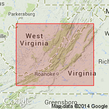
Named the Healing Springs sandstone member of the New Scotland limestone for Healing Springs, Bath Co., central western VA. South of Monterey, VA the New Scotland limestone becomes highly arenaceous in its lower half, as at Bolar Springs and Dry Run, and finally changes into heavy-bedded gray calcareous sandstone as at Clifton Forge, Gala, and in gap west of Healing Springs. This sandstone composes the Healing Springs sandstone member. Thickness is 8 to 20 feet. The Healing Springs is of Early Devonian age.
Source: GNU records (USGS DDS-6; Reston GNULEX).

- Usage in publication:
-
- Healing Springs Sandstone
- Modifications:
-
- Overview
- AAPG geologic province:
-
- Appalachian basin
Summary:
The Healing Springs Sandstone of the Helderberg Group consists of light-gray, medium- to coarse-grained, cross-laminated, calcareous sandstone with local lenses of chert. Present in Alleghany, Bath, and Augusta Cos. where it is generally less than 20 feet thick. Conformably overlies the New Creek Limestone and underlies the Licking Creek Limestone. Unit appears to be a northeast extending tongue of the Rocky Gap Sandstone.
Source: GNU records (USGS DDS-6; Reston GNULEX).
For more information, please contact Nancy Stamm, Geologic Names Committee Secretary.
Asterisk (*) indicates published by U.S. Geological Survey authors.
"No current usage" (†) implies that a name has been abandoned or has fallen into disuse. Former usage and, if known, replacement name given in parentheses ( ).
Slash (/) indicates name conflicts with nomenclatural guidelines (CSN, 1933; ACSN, 1961, 1970; NACSN, 1983, 2005, 2021). May be explained within brackets ([ ]).

