The National Geologic Map Database is migrating to a new infrastructure. We apologize for any service disruptions during this process.
|
|---|


- Usage in publication:
-
- Hayfork Bally Meta-andesite*
- Modifications:
-
- Named
- Dominant lithology:
-
- Andesite
- Chert
- Tuff
- AAPG geologic province:
-
- Klamath Mountains province
Summary:
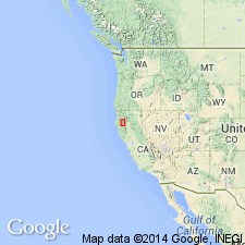
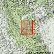
Named for mountain peak, 12 km north-northeast of Hayfork, CA. Type locality is exposures along main Forest Service road that crosses north slope of Hayfork Bally at altitude of 1200-1370 m, secs.27-28 T33N R12E and along branch of road that climbs north and west slopes of peak to lookout tower, Hayfork quad, Trinity Co, CA. Is lowest unit in Hayfork terrane. Consists of light- to dark-gray-green meta-andesite over 1,000 m thick. Contains equant augite and blocky plagioclase phenocrysts in fine-grained groundmass. Forms blocky outcrops and light-colored soil. Bedded character displayed locally by interlayers of radiolarian chert, tuff, and agglomerate. Intruded by Jurassic Ironside Mountain batholith and Wildwood pluton. Structurally underlies middle unit of Hayfork terrane, or unconformably underlies Cretaceous or Tertiary rocks. Is Jurassic(?) age.
Source: GNU records (USGS DDS-6; Menlo GNULEX).
- Usage in publication:
-
- Hayfork Bally Meta-andesite*
- Modifications:
-
- Age modified
- AAPG geologic province:
-
- Klamath Mountains province
Summary:
Mapped as unit in Western Hayfork subterrane in Dubakella Mountain 15' quad, Klamath Mountains province, CA. Age is herein considered Middle Jurassic on basis of probable cogenetic relation with Ironside Mountain batholith (approx. 170 Ma, Lanphere and others, 1968, revised; Wright, 1982) which intrudes unit to the north. Hayfork Bally Meta-andesite thought to be entirely marine and probably represents island-arc deposit.
Source: GNU records (USGS DDS-6; Menlo GNULEX).
For more information, please contact Nancy Stamm, Geologic Names Committee Secretary.
Asterisk (*) indicates published by U.S. Geological Survey authors.
"No current usage" (†) implies that a name has been abandoned or has fallen into disuse. Former usage and, if known, replacement name given in parentheses ( ).
Slash (/) indicates name conflicts with nomenclatural guidelines (CSN, 1933; ACSN, 1961, 1970; NACSN, 1983, 2005, 2021). May be explained within brackets ([ ]).