- Usage in publication:
-
- Hay Creek Greenstone*
- Modifications:
-
- Named
- Dominant lithology:
-
- Greenstone
- Slate
- Metabasalt
- AAPG geologic province:
-
- Midcontinent region
Summary:
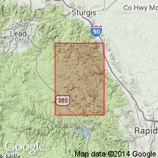
Named as the basal formation of the Windy Flats Group (new) for exposures designated the type locality north of Hay Creek in sec 1, T3N, R4E, Lawrence Co, SD in the Midcontinent region. Mapped as a linear strip that extends along the west to west-central part of the map in Lawrence, Meade, and Pennington Cos. Overlies Gingrass Draw Slate (new) of middle Precambrian age. Underlies Reausaw Slate (new), upper formation of Windy Flats Group of middle Precambrian age. Consists of ellipsoidal metabasalt, pelitic slate, several ferruginous chert units, and several thin cherty lean-ferruginous iron-formations between basalt flows. Greenstone and metabasalt not separated everywhere. Of middle Precambrian age.
Source: GNU records (USGS DDS-6; Denver GNULEX).

- Usage in publication:
-
- Hay Creek Greenstone*
- Modifications:
-
- Age modified
- AAPG geologic province:
-
- Midcontinent region
Summary:
Mapped with Early Proterozoic units Xgb, Xb (Pl. 1) in Nemo area, Lawrence Co, Midcontinent region of SD. Thought to be about 2.0 Ga. Is older than Rapid Creek Greenstone of Rochford area, Pennington Co. Geologic map.
Source: GNU records (USGS DDS-6; Denver GNULEX).
For more information, please contact Nancy Stamm, Geologic Names Committee Secretary.
Asterisk (*) indicates published by U.S. Geological Survey authors.
"No current usage" (†) implies that a name has been abandoned or has fallen into disuse. Former usage and, if known, replacement name given in parentheses ( ).
Slash (/) indicates name conflicts with nomenclatural guidelines (CSN, 1933; ACSN, 1961, 1970; NACSN, 1983, 2005, 2021). May be explained within brackets ([ ]).

