- Usage in publication:
-
- Hattiesburg phase
- Hattiesburg formation
- Modifications:
-
- Original reference
- Dominant lithology:
-
- Silt
- Clay
- AAPG geologic province:
-
- Mid-Gulf Coast basin
Johnson, L.C., 1893, The Miocene group of Alabama [abs.]: Science, new series, v. 21, p. 90-91.
Summary:
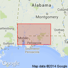
Pg. 90-91. Hattiesburg phase or Hattiesburg formation. More remote from the Great River [Mississippi], and something farther, the less siliceous the formation becomes, at Hattiesburg, and in that part of Leaf River from Okatoma to Rogers Creek and on the Chickasawhay above Leakesville, a third phase of the Miocene Grand Gulf group is exhibited, abounding in phytogene remains --almost lignitic. This is the Hattiesburg phase or formation. Extends into Alabama and has been traced across Mississippi. [Age is early and middle Miocene.]
[Named from exposures at Hattiesburg, Forrest Co., MS.]
Source: US geologic names lexicon (USGS Bull. 896, p. 924).
- Usage in publication:
-
- Hattiesburg clay*
- Modifications:
-
- Areal extent
- AAPG geologic province:
-
- Gulf Coast basin
- Mid-Gulf Coast basin
Summary:
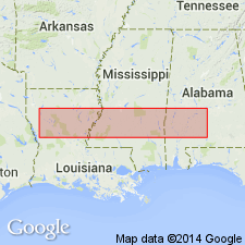
Hattiesburg clay. Consists of massive nonmarine blue and gray clays with subordinate amounts of sands and sandstones. Unconformably underlies Pascagoula clay and conformably overlies Catahoula sandstone. Forms lower part of Fleming clay of Veatch. Thickness 300 to 350 feet in Alabama and Louisiana and 450 feet maximum in Mississippi. [Age is early and middle Miocene.]
[Recognized in Coastal Plain of Alabama, Mississippi, Louisiana, and eastern Texas.]
Source: US geologic names lexicon (USGS Bull. 896, p. 924).
- Usage in publication:
-
- Hattiesburg†
- Modifications:
-
- Abandoned
- AAPG geologic province:
-
- Mid-Gulf Coast basin
Summary:
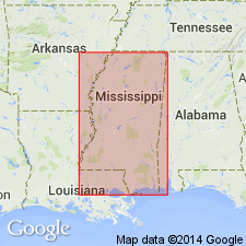
"Units presently referred to as middle Miocene Hattiesburg, upper Miocene Pascagoula, and Pliocene Graham Ferry Formations do not have valid paleontological, lithologic or other stratigraphic support for their existence. They can not be satisfactorily delineated and correlated with units in other areas and it is suggested that these terms be discontinued and mapped as Neogene Undifferentiated nonmarine clastics."
Source: GNU records (USGS DDS-6; Reston GNULEX).
- Usage in publication:
-
- Hattiesburg Formation
- Modifications:
-
- Overview
- AAPG geologic province:
-
- Mid-Gulf Coast basin
Summary:
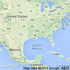
"It has been assumed that pre-Citronelle lutites found along strike as far west as the Mississippi River and a far east as the state boundary with AL warrant a designation as Hattiesburg Formation." Adamczak (1986) determined that smectite is the predominant clay mineral of the Hattiesburg. Smectite is abundant in most outcrops that authors assume to be Hattiesburg in the study area and negligible in the strata assigned to the overlying Citronelle Formation. A table of field identification criteria for the Hattiesburg includes the fact that it is usually massive-bedded, mostly lutitic with few beds of sand or sandstone, unweathered it is gray to green with Fe oxide-stained mottles, and lignitic material or calcite is often present. Unit is predominantly silt and clay and occurs at elevations below about 300 ft. Age given as Miocene(?).
Source: GNU records (USGS DDS-6; Reston GNULEX).
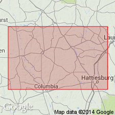
- Usage in publication:
-
- Hattiesburg Formation
- Modifications:
-
- Overview
- AAPG geologic province:
-
- Mid-Gulf Coast basin
Summary:
Because the contact between the Catahoula and the overlying Hattiesburg Formations has never been seen and because the two units are lithologic similar, it is suggested here that they be considered a single mapping unit. The Hattiesburg can be seen through the entire working area. It is composed of pale-greenish-gray and pale-yellowish-gray massive clay, clayey silt, and sandy silt, interbedded with several thin lenses of very pale yellowish-gray to pale-brownish-gray fine- to medium-grained sandstone. Massive bedding is common in the clay and silt; horizontal bedding is common in the sandy units. Mean grain size ranges from very fine grained to medium grained. Contains less mica than the Catahoula. Clay mineral include smectite, kaolinite, and illite. Hattiesburg clays display a "popcorn" weathering texture. Underlies the Citronelle Formation. Age is Miocene.
Source: GNU records (USGS DDS-6; Reston GNULEX).
- Usage in publication:
-
- Hattiesburg Formation*
- Modifications:
-
- Not used
- AAPG geologic province:
-
- Mid-Gulf Coast basin
GNU Staff, 1995, Draft copy of Otvos, E.G., Mississippi Gulf Coast; geologic evolution, stratigraphy, coastal geomorphology, and Gulf-wide Pleistocene correlations, USGS Bull. XXXX (unpublished): U.S. Geological Survey Digital Data Series, DDS-6, 1 CD-ROM., release 3
Summary:
A maximum 4,900-ft-thick Miocene sequence underlies younger sandy-clayey alluvial-paralic deposits in MS. In absence of clearly definable and correlatable litho- or biostratigraphic horizons to bracket them, application of formation names, previously assigned to paralic-alluvial intervals (Oligocene to Miocene Catahoula Formation, Miocene Hattiesburg and Pascagoula Formations, and Pliocene Graham Ferry Formation; Brown and others, 1944) is unacceptable in MS. In intervals for which a Miocene or Pliocene age cannot be established, the term "undifferentiated Neogene clastics" is recommended. Whenever applicable, the names Pascagoula and Graham Ferry Members of Pensacola Formation are now used. Author follows usage of Otvos (1994).
Source: GNU records (USGS DDS-6; Reston GNULEX).
For more information, please contact Nancy Stamm, Geologic Names Committee Secretary.
Asterisk (*) indicates published by U.S. Geological Survey authors.
"No current usage" (†) implies that a name has been abandoned or has fallen into disuse. Former usage and, if known, replacement name given in parentheses ( ).
Slash (/) indicates name conflicts with nomenclatural guidelines (CSN, 1933; ACSN, 1961, 1970; NACSN, 1983, 2005, 2021). May be explained within brackets ([ ]).

