- Usage in publication:
-
- Hato Puerco tuff*
- Modifications:
-
- Overview
- AAPG geologic province:
-
- Caribbean region
Summary:
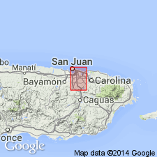
The Hato Puerco tuff is here adopted. Consists of massive pyroclastic rocks with thick sections of flow rocks. In the Fajardo district it overlies the Guzman formation; in San Juan district it forms the main mass of the volcanic cone and is the lowest unit mapped. Unconformably and conformably underlies the Guaynabo formation. Thickness not estimated because of the massiveness of the unit. Age is Late Cretaceous(?) based on fossils found in rocks of the older complex.
Source: GNU records (USGS DDS-6; Reston GNULEX).

- Usage in publication:
-
- Hato Puerco Tuff*
- Modifications:
-
- Revised
- AAPG geologic province:
-
- Caribbean region
Summary:
Kaye's (1959) Hato Puerco Tuff in the Aguas Buenas quadrangle included parts of the Santa Olaya Lava and Camarones Sandstone, both here revised, and the Carraizo Breccia, here named.
Source: GNU records (USGS DDS-6; Reston GNULEX).

- Usage in publication:
-
- Hato Puerco Formation*
- Modifications:
-
- Revised
- Redescribed
- Biostratigraphic dating
- AAPG geologic province:
-
- Caribbean region
Summary:
In the Gurabo and El Yunque quadrangles the Hato Puerco Tuff is redefined as the Hato Puerco Formation and beds assigned to the Guzman Formation by Meyerhoff and Smith (1931) are here included in the Hato Puerco. The stratigraphic position of the Hato Puerco is also revised. Overlies the Tabonuco Formation or the Barrazas Formation; conformably underlies the Cambalache Formation. Age is Late Cretaceous (early Cenomanian to Turonian) based on rudistids.
Source: GNU records (USGS DDS-6; Reston GNULEX).

- Usage in publication:
-
- Hato Puerco Formation*
- Modifications:
-
- Overview
- AAPG geologic province:
-
- Caribbean region
Summary:
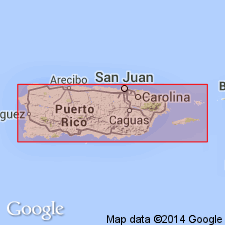
The Hato Puerco Formation occurs in eastern Puerto Rico and consists of andesitic to basaltic volcaniclastic sandstone and breccia, mudstone, conglomerate, and lava. Maximum estimated thickness is 2600 meters. The Hato Puerco is of Late Cretaceous age.
Source: GNU records (USGS DDS-6; Reston GNULEX).
For more information, please contact Nancy Stamm, Geologic Names Committee Secretary.
Asterisk (*) indicates published by U.S. Geological Survey authors.
"No current usage" (†) implies that a name has been abandoned or has fallen into disuse. Former usage and, if known, replacement name given in parentheses ( ).
Slash (/) indicates name conflicts with nomenclatural guidelines (CSN, 1933; ACSN, 1961, 1970; NACSN, 1983, 2005, 2021). May be explained within brackets ([ ]).

