

- Usage in publication:
-
- Hatchetigbee series*
- Modifications:
-
- Named
- Dominant lithology:
-
- Clay
- Sand
- AAPG geologic province:
-
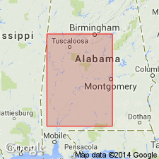
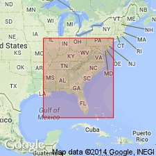
- Mid-Gulf Coast basin
Summary:
Named the Hatchetigbee series for Hatchetigbee Bluff on Tombigbee River, Washington Co., AL. Includes all strata between Tallahatta formation and uppermost Wood's Bluff fossiliferous beds or Bashi marl. Consists of 170 to 175 feet of brownish gray sandy clays or clayey sands alternating with bands of dark brown or purple clays and sands. Unit is top formation of Wilcox group. The Hatchetigbee is of early Eocene age.
Source: GNU records (USGS DDS-6; Reston GNULEX).

- Usage in publication:
-
- Hatchetigbee Formation
- Modifications:
-
- Overview
- AAPG geologic province:
-
- Mid-Gulf Coast basin
Summary:
Hatchetigbee Formation of Wilcox Group in AL is gray, brown, and olive-green locally cross-bedded, very fine to fine-grained sand and interlaminated carbonaceous, sparsely micaceous, silty clay, silt, and sandy clay. The lower 6 to 35 ft are assigned to the Bashi Marl Member, a pale-olive to greenish-gray fine-grained, abundantly glauconitic fossiliferous sand and marl containing boulder-size calcareous sandstone concretions. Thickness of the Hatchetigbee ranges from 250 ft in the western Coastal Plain to 35 ft in southeastern AL where fossiliferous, glauconitic, marly sand beds make up most of the formation. Age is Eocene (early Ypresian).
Source: GNU records (USGS DDS-6; Reston GNULEX).
- Usage in publication:
-
- Hatchetigbee Formation*
- Modifications:
-
- Biostratigraphic dating
- AAPG geologic province:
-
- Mid-Gulf Coast basin
Summary:
The Bashi and Hatchetigbee Formations of Eocene age intertongue throughout the Mid-Gulf Coast basin. Authors follow usage of Gibson (1982) for the Bashi. The Bashi and Hatchetigbee Formations include calcareous nannofossil zones NP10 and NP11 and are of early Eocene age.
Source: GNU records (USGS DDS-6; Reston GNULEX).
For more information, please contact Nancy Stamm, Geologic Names Committee Secretary.
Asterisk (*) indicates published by U.S. Geological Survey authors.
"No current usage" (†) implies that a name has been abandoned or has fallen into disuse. Former usage and, if known, replacement name given in parentheses ( ).
Slash (/) indicates name conflicts with nomenclatural guidelines (CSN, 1933; ACSN, 1961, 1970; NACSN, 1983, 2005, 2021). May be explained within brackets ([ ]).