


- Usage in publication:
-
- Harveyville shale member
- Modifications:
-
- Original reference
- Dominant lithology:
-
- Shale
- AAPG geologic province:
-
- Forest City basin
- Nemaha anticline
Summary:
Pg. 10. Harveyville shale, middle member of Preston ("Emporia") limestone formation of Wabaunsee group. Consists of greenish, bluish shale, locally a subzone nearly black, argillaceous to calcareous, quite fossiliferous, 3 to 4 feet thick to west, 7 feet thick to east. Underlies Elmont limestone member and overlies Reading limestone member, both of Preston ("Emporia"). Age is Late Pennsylvanian (Virgil).
[Origin of name not stated.]
Source: US geologic names lexicon (USGS Bull. 896, p. 921); GNC KS-NE Pennsylvanian Corr. Chart, sheet 2, Oct. 1936.

- Usage in publication:
-
- Harveyville shale
- Modifications:
-
- Principal reference
- Revised
- AAPG geologic province:
-
- Forest City basin
Summary:
Pg. 226. Harveyville shale of Wabaunsee group, which is first defined in this report, includes beds overlying Reading limestone and underlying Elmont limestone. It is mostly bluish or yellowish brown and clayey, but locally contains sandy shale and thin platy sandstone, with a coal bed locally above the sandstone. Thickness 1 to 25+/- feet. Identified at many places from Nebraska to Oklahoma and is undoubtedly continuous across Kansas. Age is Late Pennsylvanian (Virgil).
Type locality: near Harveyville, southeastern part of Wabaunsee Co., eastern KS. Good section in sec. 25, T. 15 S., R. 13 E.
Source: US geologic names lexicon (USGS Bull. 896, p. 921); GNC KS-NE Pennsylvanian Corr. Chart, sheet 2, Oct. 1936.

- Usage in publication:
-
- Harveyville shale member*
- Modifications:
-
- Revised
Summary:
Pg. 2274 (fig. 1), 2276. Harveyville shale member of Emporia limestone. Rank reduced to member status in Emporia limestone (redefined). Overlies Reading limestone member; underlies Elmont limestone member. Age is Late Pennsylvanian (Virgilian).
Source: US geologic names lexicon (USGS Bull. 1200, p. 1696).
- Usage in publication:
-
- Harveyville shale member*
- Modifications:
-
- Areal extent
- AAPG geologic province:
-
- Chautauqua platform
Summary:
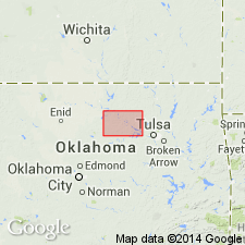
Pg. 57-58. Harveyville shale member of Emporia limestone. Described in Pawnee County, northern Oklahoma, where it is 35 to 53 feet thick. Overlies Reading limestone member; underlies Elmont limestone member. Extends southward across Pawnee County into Payne County; southern extent not known. Age is Late Pennsylvanian (Virgilian).
Source: US geologic names lexicon (USGS Bull. 1200, p. 1696).

- Usage in publication:
-
- Harveyville shale
- Modifications:
-
- Areal extent
- AAPG geologic province:
-
- Forest City basin
Summary:
Pg. 13, fig. 5. Harveyville shale of Wabaunsee group. Geographically extended into southwestern Iowa where it is classified as formation in Wabaunsee group. Where exposed in Fremont County consists of gray shale in lower part, limy nodules near center, and brown shale in upper part. Thickness 3 feet. Underlies Elmont limestone; overlies Reading limestone. Age is Late Pennsylvanian (Virgilian).
Source: US geologic names lexicon (USGS Bull. 1200, p. 1696).
For more information, please contact Nancy Stamm, Geologic Names Committee Secretary.
Asterisk (*) indicates published by U.S. Geological Survey authors.
"No current usage" (†) implies that a name has been abandoned or has fallen into disuse. Former usage and, if known, replacement name given in parentheses ( ).
Slash (/) indicates name conflicts with nomenclatural guidelines (CSN, 1933; ACSN, 1961, 1970; NACSN, 1983, 2005, 2021). May be explained within brackets ([ ]).