

- Usage in publication:
-
- Hartt Cabin Bed*
- Modifications:
-
- Named
- Dominant lithology:
-
- Sandstone
- Siltstone
- Mudstone
- Tuff
- AAPG geologic province:
-
- Green River basin
Summary:
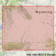
Named as upper bed (of 3 named beds) of Laney Member of Green River Formation for exposures near head of Hartt Cabin Draw in northwest part of T14N, R93W east to slopes of Flat Top Mountain in Ts 14 and 15N, R93W, Sweetwater Co, WY in Washakie basin of Greater Green River basin. Type section measured in secs 30, 31, and 32, T15N, R93W. Is a sequence of interbedded sandstone, siltstone, mudstone, shale, oil shale, tuff, limestone, and dolomite. Is 625 ft thick at type. Rests unconformably on LaClede Bed (new name) in east part of basin where contact between two is placed at top of green shale marker of LaClede which is in contact with chalky, gray-brown weathered Hartt Cabin. Is laterally equivalent to Kinney Rim Member of Washakie Formation and to the Sand Butte Bed of Laney Member. Is of middle Eocene age, fossil mammal locality near base in northeast part of basin.
Source: GNU records (USGS DDS-6; Denver GNULEX).
- Usage in publication:
-
- Hartt Cabin Bed*
- Modifications:
-
- Overview
- AAPG geologic province:
-
- Green River basin
Summary:
Paleogeographic map (fig. 88) of this bed of Laney Member of Green River Formation showing depositional environments in Greater Green River basin. Deposited during drying-up stages of Lake Gosiute as lake periodically expanded and contracted but eventually retreated from central and southern part of basin into southeastern corner of basin. Due to expansions and contractions, Hartt Cabin intertongues with LaClede and Sand Butte Beds of Laney, with Bridger Formation, and with Kinney Rim Member of Washakie Formation. Hartt Cabin occupied maximum of 6,100 sq mi of basin. Composed of fluvial sandstone, siltstone, mudstone, and shale, and interbedded lacustrine oil shale, sandstone, siltstone, and limestone. Hartt Cabin reaches maximum known thickness of 800 ft in subsurface near center of Washakie basin though thickness is variable due to intertonguing. Unconformably underlies Adobe Town Member of Washakie Formation in eastern part of Washakie basin and unconformably underlies Bishop Conglomerate in central part of Sand Wash basin. Generalized stratigraphic correlation chart (fig. 41). Eocene age.
Source: GNU records (USGS DDS-6; Denver GNULEX).
For more information, please contact Nancy Stamm, Geologic Names Committee Secretary.
Asterisk (*) indicates published by U.S. Geological Survey authors.
"No current usage" (†) implies that a name has been abandoned or has fallen into disuse. Former usage and, if known, replacement name given in parentheses ( ).
Slash (/) indicates name conflicts with nomenclatural guidelines (CSN, 1933; ACSN, 1961, 1970; NACSN, 1983, 2005, 2021). May be explained within brackets ([ ]).