The National Geologic Map Database is migrating to a new infrastructure. We apologize for any service disruptions during this process.
|
|---|


- Usage in publication:
-
- Harsin Ranch Formation
- Modifications:
-
- Overview
- AAPG geologic province:
-
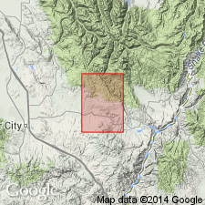
- Snake River basin
Summary:
At the time of writing, the Clover Creek Greenstone was in the process of being elevated to group rank and subdivided into two new formations, the Harsin Ranch and the Tucker Creek Formations of Permian and late Triassic ages respectively. Names and classification credited to Koch and Bowen (1962, written commun.).
Type locality and derivation of name not stated.
[As of 2006, these revisions have not been published. And, no references in GNC index card files to indicate usage since 1962. Harsin Ranch Formation therefore considered invalid and obsolete.]
Source: Publication; US geologic names lexicon (USGS Bull. 1350, p. 322).
For more information, please contact Nancy Stamm, Geologic Names Committee Secretary.
Asterisk (*) indicates published by U.S. Geological Survey authors.
"No current usage" (†) implies that a name has been abandoned or has fallen into disuse. Former usage and, if known, replacement name given in parentheses ( ).
Slash (/) indicates name conflicts with nomenclatural guidelines (CSN, 1933; ACSN, 1961, 1970; NACSN, 1983, 2005, 2021). May be explained within brackets ([ ]).