

- Usage in publication:
-
- Harrisburg gypsiferous member*
- Modifications:
-
- Original reference
- Dominant lithology:
-
- Limestone
- Shale
- Gypsum
- AAPG geologic province:
-
- Great Basin province
Summary:
Aug. 15, 1921. Pg. 90-92. Harrisburg gypsiferous member of Kaibab limestone. Present in southwestern Utah and northwestern Arizona. Gray, thin-bedded limestone (some of it containing many small angular fragments of chert) and gray, red, and yellow shale, some gypsum. Thickness 137 to 160 feet [0 to 280+/- feet in USGS Prof. Paper 129, p. 56, 1922]. Top member of Kaibab limestone. Unconformably overlain by Rock Canyon conglomeratic member of Moenkopi formation. Age is Permian.
Named from occurrence in Harrisburg dome, 8 mi east of St. George, Washington Co., southwestern UT.
Source: US geologic names lexicon (USGS Bull. 896, p. 915).
- Usage in publication:
-
- Harrisburg gypsiferous member*
- Modifications:
-
- Overview
- AAPG geologic province:
-
- Plateau sedimentary province
- Great Basin province
Summary:
Pg. 35. Harrisburg gypsiferous member of Kaibab limestone. The alpha, or uppermost member of Kaibab, as described herein, has been referred to variously as the A member, the Super Aubrey, Bellerophon limestone, and Harrisburg gypsiferous member. Age is Permian.
Source: US geologic names lexicon (USGS Bull. 1200, p. 1685-1686).

- Usage in publication:
-
- Harrisburg Member*
- Modifications:
-
- Redescribed
- Reference
- AAPG geologic province:
-
- Plateau sedimentary province
- Basin-and-Range province
- Great Basin province
Summary:
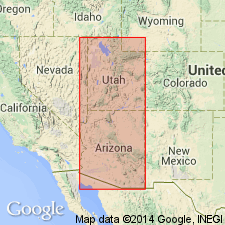
Name changed --Harrisburg Gypsiferous Member to Harrisburg Member of Kaibab Formation (redescribed); gypsum not pervasive lithology throughout member's extent. Slope- and ledge-forming upper member of Kaibab Formation (redescribed). Overlies Fossil Mountain Member (named) of Kaibab. Unconformably underlies Moenkopi Formation. Type section designated at Harrisburg dome 8 mi north of St. George, Washington Co, UT, Great Basin province, where Reeside and Bassler (1922) measured section of fossiliferous limestone 250 ft thick and basal yellow gypsiferous shale. Limestone at type has chert layers and angular pieces. 272 ft thick at another measured section 10 mi southwest of type. Reference section designated as section measured from southwest corner sec 12, T33N, R9W to top of Hurricane Cliffs, Mohave Co, AZ where member 174.2 ft thick consisting of interbedded: 1) fossiliferous limestone; 2) white, sugary, massive, slope-forming gypsum; 3) some tan, fine-grained, thin-bedded dolomite with rough pitted surface; 4) white, tan, gray chert occurring as bedded or as nodular masses in limestone; 5) gray, well-indurated, calcareous, medium-grained, rounded quartz sandstone. 160-300 ft thick. East limit a north-south line west of Page, Coconino Co, Plateau sedimentary province, to Verde Valley, Yavapai Co, Basin-and-Range province, where merges with sandstone facies of Fossil Mountain. Fossil brachiopods, gastropods. Nomenclature chart. Early Permian, Leonardian.
Source: GNU records (USGS DDS-6; Denver GNULEX).

- Usage in publication:
-
- Harrisburg Member*
- Modifications:
-
- Areal extent
- AAPG geologic province:
-
- Great Basin province
Summary:
Mapped as the upper member of Kaibab Formation in east-central Lincoln Co., NV in the Great Basin province where it overlies Fossil Mountain Member of Kaibab and unconformably underlies lower red member and Rock Creek Conglomerate Member (undivided) of Moenkopi Formation. Consists of thick bedded to massive light gray cherty limestone with thin-bedded to laminated gray dolomite and gypsum interbeds. Forms cliffs and ledges. Dolomite commonly has vuggy porosity. Abundant pink or orange chert. One distinctive white chert bed 1 m thick forms ledge near base of member. Is 80 m thick. Of Early Permian, Leonardian age.
Source: GNU records (USGS DDS-6; Denver GNULEX).
For more information, please contact Nancy Stamm, Geologic Names Committee Secretary.
Asterisk (*) indicates published by U.S. Geological Survey authors.
"No current usage" (†) implies that a name has been abandoned or has fallen into disuse. Former usage and, if known, replacement name given in parentheses ( ).
Slash (/) indicates name conflicts with nomenclatural guidelines (CSN, 1933; ACSN, 1961, 1970; NACSN, 1983, 2005, 2021). May be explained within brackets ([ ]).