

- Usage in publication:
-
- Harrington formation*
- Modifications:
-
- Named
- Dominant lithology:
-
- Limestone
- Shale
- AAPG geologic province:
-
- Great Basin province
Summary:
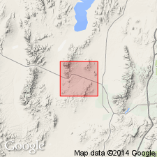
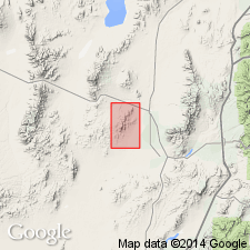
Named for the Harrington-Hickory mine, T28S, R11W, Beaver Co, UT in the Great Basin province. No type locality designated. Mapped in southeast part of area from north of Harrington-Hickory mine to south border of geologic map, and around the Old Hickory mine at the central-east edge of geologic map. Conformably overlies the Pennsylvanian? Elephant limestone (new). The next younger unit in the area is the Quaternary alluvial deposits and lakebeds. The lower contact is marked by a change from limestone (Elephant) to gray and red, thin-bedded shales (Harrington). Is about 5,000 ft thick. Consists of red and gray, thin-bedded shales that are ripple-marked and have raindrop impressions at base, and overlying heavy-bedded limestone, and an upper thinner-bedded limestone and shale. Local lenses of quartzite. Fossils listed (gastropods, ammonites, mollusks, etc.). Assigned to Triassic because formation has an Early Triassic ammonite fauna.
Source: GNU records (USGS DDS-6; Denver GNULEX).
- Usage in publication:
-
- Harrington formation*
- Modifications:
-
- Revised
- AAPG geologic province:
-
- Great Basin province
Summary:
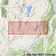
Williams limestone member (new) of Harrington formation occurs in Harrington-Hickory mine area. Age of Harrington formation given as Triassic.
Source: GNU records (USGS DDS-6; Menlo GNULEX).
- Usage in publication:
-
- Harrington Formation
- Modifications:
-
- Not used
Summary:
Not used. Lower part of Butler's (1913) Harrington is equivalent to the Moenkopi Formation of this paper. The upper part of Butler's Harrington is equivalent to Shinarump Conglomerate and to the Chinle Formation and Navajo Sandstone of this paper.
Source: GNU records (USGS DDS-6; Denver GNULEX).
For more information, please contact Nancy Stamm, Geologic Names Committee Secretary.
Asterisk (*) indicates published by U.S. Geological Survey authors.
"No current usage" (†) implies that a name has been abandoned or has fallen into disuse. Former usage and, if known, replacement name given in parentheses ( ).
Slash (/) indicates name conflicts with nomenclatural guidelines (CSN, 1933; ACSN, 1961, 1970; NACSN, 1983, 2005, 2021). May be explained within brackets ([ ]).