- Usage in publication:
-
- Harquar formation
- Modifications:
-
- First used
- Dominant lithology:
-
- Sandstone
- Siltstone
- Conglomerate
- AAPG geologic province:
-
- Basin-and-Range province
Summary:
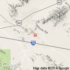
First published use as [informal?] term in Harquar plate for about 1,900 m thick volcanic-lithic sandstone, conglomerate, siltstone, associated intermediate to silicic volcanic and hypabyssal rocks. Intent to name, source of geographic name, designation of type not stated. Mapped in western Little Harquahala and western Harquahala Mountains, La Paz Co, AZ, Basin-and-Range province. Geologic map. Divisible into (ascending): 1) gray, medium- to coarse-grained conglomeratic (20-60% pebbles and cobbles of vitreous quartzite, volcanic rock fragments, Paleozoic carbonate) sandstone; 2) Hovatter volcanic unit (informal?, first used) of volcanic flows, hypabyssal intrusive rocks, tuff, volcaniclastic sedimentary rocks; 3) massive, poorly sorted conglomerate of pebbles to cobbles of volcanics, Paleozoic quartzite and carbonate in matrix of gray, volcanic-lithic sandstone; 4) upper sandstone 1,200 m thick of interbedded sandstone, conglomeratic sandstone, conglomerate with abundant, thin, maroon, siltstone partings. Upper sandstone is gray, fine- to coarse-grained, rich in volcanic fragments. Conglomerate has pebble to cobble size clasts of volcanic, sedimentary, and quartzite. Lower contact is a fault; upper contact with McCoy Mountains Formation a fault; top and base of Hovatter faulted. Deposited in alluvial environment in which volcanism widespread. Upward fining and increase of compositional maturity suggest waning of tectonic activity.
Source: GNU records (USGS DDS-6; Denver GNULEX).
For more information, please contact Nancy Stamm, Geologic Names Committee Secretary.
Asterisk (*) indicates published by U.S. Geological Survey authors.
"No current usage" (†) implies that a name has been abandoned or has fallen into disuse. Former usage and, if known, replacement name given in parentheses ( ).
Slash (/) indicates name conflicts with nomenclatural guidelines (CSN, 1933; ACSN, 1961, 1970; NACSN, 1983, 2005, 2021). May be explained within brackets ([ ]).

