The National Geologic Map Database is migrating to a new infrastructure. We apologize for any service disruptions during this process.
|
|---|


- Usage in publication:
-
- Harney Peak granite
- Modifications:
-
- First used
- Dominant lithology:
-
- Granite
- AAPG geologic province:
-
- Midcontinent region
Summary:
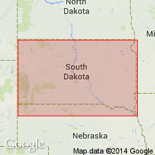
First published use of name. [Description of rocks assigned to Harney Peak in the report are attributed to an earlier paper by Van Hise, "The pre-Cambrian rocks of the Black Hills," published in Geological Society of America Bulletin, v. 1, p. 203-244, 1890 repeated here even though name Harney Peak granite not used in 1890 report.] Is a granite that includes irregular fragments--some large, some small--of schist. Schist fragments become more abundant away from the central core. Origin of granite discussed as to whether it is metamorphic or pegmatitic or eruptive. The granite is coarse-grained, muscovite granite. The important minerals are muscovite, quartz, and feldspar. Feldspars present are orthoclase, microcline, and plagioclase. Immediately adjacent to the granite in the southern part of the hills, are very coarse muscovite-biotite gneisses with much feldspar. These gneisses may be foliated phases of the granite or clastic rocks caught up in the granite. The nearby slates and schists whose origin is debated are thought to be older than the granite; they dip at a high angle away from the granite. Simplified geologic map on which granite bodies shown south of Hill City, Pennington Co, SD and around Custer, Custer Co, SD (Midcontinent region). Of pre-Cambrian age.
Source: GNU records (USGS DDS-6; Denver GNULEX).
- Usage in publication:
-
- Harney Peak granite
- Modifications:
-
- Overview
- AAPG geologic province:
-
- Midcontinent region
Summary:
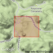
Forms the core of the Black Hills uplift. Outline of granite mass has not been shown on a published map. Thought to have an oval outline about 7 x 10 mi in dimension. Considered to be pre-Cambrian. Report area is concerned with the Etta mine about a mile south of town of Keystone, Pennington Co, SD in the Midcontinent region. Parts of the granite are pegmatitic. Schist inclusions abundant. The granite is medium to fine textured, soda rich, high in quartz and muscovite with orthoclase, microcline, and albite as the chief feldspars. Has many black needles of tourmaline. Was intruded in a series of metamorphic rocks--phyllite, schists, gneisses, quartzites, amphibolites. Contact between the pegmatite and the metamorphic rocks is sharp.
Source: GNU records (USGS DDS-6; Denver GNULEX).
- Usage in publication:
-
- Harney Peak Granite
- Modifications:
-
- Geochronologic dating
- AAPG geologic province:
-
- Midcontinent region
Summary:
Also called Harney granite. Rb-Sr isotope analyses on 10 samples in southern Black Hills, SD, Midcontinent region, yield a total rock isochron granite age of 1744 +/-12 m.y. Geologic map. Forms the major dome in the Black Hills. The granite is coarse grained, sodic and leucocratic and has variable amounts of tourmaline. Diverse in composition and texture. Has xenoliths of metamorphic rocks. Isolated xenolithic remnants and lit-par-lit injection of magma in schistose rock peripheral to the intrusion suggest assimilation of country rock occurred during emplacement.
Source: GNU records (USGS DDS-6; Denver GNULEX).

- Usage in publication:
-
- Harney Peak Granite*
- Modifications:
-
- Age modified
- Areal extent
- AAPG geologic province:
-
- Midcontinent region
Summary:
Occupies a 40 sq mi area between Custer, Custer Co and Keystone, Pennington Co, SD in the Midcontinent region. Has an Rb-Sr whole-rock date of 1,697 +/-33 Ma which is interpreted to be the age of emplacement. May extend north beneath graywacke units to Hill City. Geologic map.
Source: GNU records (USGS DDS-6; Denver GNULEX).
For more information, please contact Nancy Stamm, Geologic Names Committee Secretary.
Asterisk (*) indicates published by U.S. Geological Survey authors.
"No current usage" (†) implies that a name has been abandoned or has fallen into disuse. Former usage and, if known, replacement name given in parentheses ( ).
Slash (/) indicates name conflicts with nomenclatural guidelines (CSN, 1933; ACSN, 1961, 1970; NACSN, 1983, 2005, 2021). May be explained within brackets ([ ]).