

- Usage in publication:
-
- Harmony Hills tuff member
- Modifications:
-
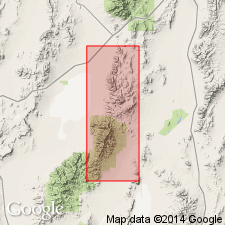
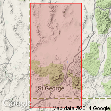
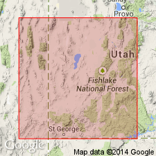
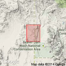
- Areal extent
- AAPG geologic province:
-
- Great Basin province
Summary:
Pg. 138 (fig. 2). Harmony Hills tuff member of Quichapa formation. Geographically extended into eastern Nevada. [Age is Oligocene.]
Source: US geologic names lexicon (USGS Bull. 1200, p. 1679-1680).
- Usage in publication:
-
- Harmony Hills tuff member
- Modifications:
-
- Original reference
- Dominant lithology:
-
- Tuff
- AAPG geologic province:
-
- Great Basin province
Summary:
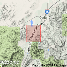
Pg. 90, 92 (fig. 2), 94-95. Harmony Hills tuff member of Quichapa formation. Uppermost member of formation. At type locality, overlies Bauers tuff member (new); underlies Rencher formation; elsewhere lava flows or other volcanic rocks, local in origin and extent, at contacts. Characteristically tan to light red brown. Only moderately indurated, but does not show signs of welding. May be an ignimbrite or may be an airfall tuff. Thickness 300 to 350 feet. Zircon age of Leach Canyon tuff member is 28 million years; this suggests that Quichapa formation is Oligocene. Discussion of ignimbrites of area. [Age is Oligocene.]
Type locality: Harmony Hills, specifically south side of Right Quichapa Canyon, Iron Springs district, southwestern UT; [Right Quichapa Canyon in Harmony Mountains, in secs. 10, 11, and 12, T. 37 S., R. 13 W., Stoddard Mountain quadrangle, Iron Co., southwestern UT].
[Misprint (US geologic names lexicon, USGS Bull. 1200, p. 1680): type locality in Stoddard Mountain quadrangle, not Mount Stoddard quadrangle.]
Source: US geologic names lexicon (USGS Bull. 1200, p. 1679-1680).
- Usage in publication:
-
- Harmony Hills Tuff
- Modifications:
-
- Revised
- AAPG geologic province:
-
- Great Basin province
Summary:
Harmony Hills Tuff. [Raised to formation rank.] Good exposures found in Condor Canyon, Black Canyon, and Delamar Range, Nevada. Covers 6,000 sq mi; average thickness is 250 feet. Overlies Little Creek Breccia (southwest Utah), unnamed basalt flow (Black Canyon, northwest of Caliente, Nevada), unnamed ignimbrite (southwest Nevada). In other sections overlies Bauers Ignimbrite. Underlies Hiko Tuff (southeast Nevada), Rencher Formation (southwest Utah).
Source: Modified from GNU records (USGS DDS-6; Menlo GNULEX).
- Usage in publication:
-
- Harmony Hills Tuff Member*
- Modifications:
-
- Adopted
- AAPG geologic province:
-
- Great Basin province
Summary:
Harmony Hills Tuff Member of Quichapa Formation of Mackin (1960) is adopted by the USGS. Chiefly tan to light red brown in color; characterized by readily visible grains of biotite, plagioclase, and other pyrogenic minerals that make up 30 to 40 percent of the rock. Includes near base schlieren of black vitrophyre that grade into surrounding rock. Top member of Quichapa Formation. Thickness 300 to 350 feet. Overlies Bauers Tuff Member of Quichapa Formation. Underlies unnamed uplifted alluvial and detrital deposits. Age is Oligocene or Miocene.
Type locality: Harmony Hills [Harmony Mountains], specifically south side of Right Quichapa Canyon [Stoddard Mountain 7.5-min quadrangle], T. 37 S., R. 13 W., Iron Co., southwestern UT. Named from Harmony Hills [Harmony Mountains].
Source: Publication; Changes in stratigraphic nomenclature, 1967 (USGS Bull. 1274-A, p. A9); GNU records (USGS DDS-6; Menlo GNULEX).
- Usage in publication:
-
- Harmony Hills Tuff Member*
- Modifications:
-
- Age modified
- Geochronologic dating
- AAPG geologic province:
-
- Great Basin province
Summary:
Harmony Hills Tuff Member of Quichapa Formation of Cook (1960). A widely distributed crystal-rich ash-flow sheet, underlies Hiko Tuff and Racer Canyon Tuff Member [of Cove Mountain Formation] of Cook (1960). K-Ar ages from 23.5 +/-0.5 Ma to 19.6 +/-0.4 Ma obtained by Armstrong (1970, Geochemica et Cosmochimica Acta, v. 34), and 19.9 +/-0.5 Ma (this report), indicate age is Miocene. [Note these are now all early Miocene according to time scale of Berggren and others (1985).]
Source: Modified from GNU records (USGS DDS-6; Menlo GNULEX).
- Usage in publication:
-
- Harmony Hills Tuff*
- Modifications:
-
- Adopted
- AAPG geologic province:
-
- Great Basin province
Summary:
Pg. B10-B11 (fig. 2), B13; see also Anderson and Rowley, 1975, GSA Spec. Paper 160, p. 1-51. Harmony Hills Tuff of Quichapa Group is adopted by the USGS. Harmony Hills Tuff Member raised in rank and assigned to Quichapa Group (now raised in rank) [following Williams, 1967, Univ. Washington PhD dissert.; Cook, 1965, Nevada Bur. Mines Rpt., no. 11]. Recognized in southwestern Utah and eastern Nevada; northernmost exposure in Red Hills, Utah. Age is middle Miocene, based on K-Ar age determinations of about 20 to 21 Ma (citing Armstrong, 1970, Geochemica et Cosmochimica Acta, v. 34).
Source: Publication; Changes in stratigraphic nomenclature, 1976 (USGS Bull. 1435-A, p. A42).
- Usage in publication:
-
- Harmony Hills Tuff*
- Modifications:
-
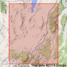
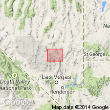
- Areal extent
- AAPG geologic province:
-
- Great Basin province
Summary:
(advance copy). Harmony Hills Tuff geographically extended into report area [east Pahranagat Range, Pahranagat Range, and northern Sheep Range]. Age is Miocene.
Source: GNU records (USGS DDS-6; Menlo GNULEX).
- Usage in publication:
-
- Harmony Hills Tuff*
- Modifications:
-
- Mapped 1:24k
- AAPG geologic province:
-
- Great Basin province
Summary:
Harmony Hills Tuff of Quichapa Group. Elevated to formation status by Cook (1965, Nevada Bur. Mines Rpt., no. 11). Described as a resistant light-gray, tan, brownish-gray, and pink, moderately welded, crystal-rich, ash-flow tuff. Thickness about 125 m. Appears to form one compound cooling unit. Isopach data on unit suggest a source in Caliente caldera complex of Nevada-Utah (citing Williams, 1967, Univ. Washington PhD dissert.). Age is Miocene. Average isotopic age is 21.6, based on five K-Ar ages on biotite and plagioclase by Armstrong (1970, Geochemica et Cosmochimica Acta, v. 34) and one on biotite by Noble and McKee (1972, Isochron/West, no. 5). Actual age may be closer to 22.5 to 22 Ma based on isotopic ages of plutons and ash-flow tuff in Iron Springs district that postdate Harmony Hills (citing Rowley and others [abs.], 1989).
Source: Publication.
- Usage in publication:
-
- Harmony Hills Tuff*
- Modifications:
-
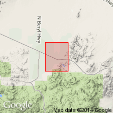
- Areal extent
- Geochronologic dating
- AAPG geologic province:
-
- Great Basin province
Summary:
Harmony Hills Tuff geographically extended to Seaman Range, Lincoln and Nye Counties, Nevada. Radiometric age is 21.6 Ma (Miocene).
Source: GNU records (USGS DDS-6; Menlo GNULEX).
- Usage in publication:
-
- Harmony Hills Tuff*
- Modifications:
-
- Mapped 1:24k
- AAPG geologic province:
-
- Great Basin province
Summary:
Harmony Hills Tuff of Quichapa Group. Light-gray to pale-red, resistant to crumbly, moderately welded, crystal-rich, andesitic ash-flow tuff. Common weathering characteristic is occurrence of crudely aligned, elongated vugs, as large as 1 cm by 4 cm. Maximum thickness in quadrangle about 80 m. Age is Miocene. Rowley and Shroba (1991, USGS GQ-1701) reviewed isotopic age dating of this tuff and concluded that it is 22.5 to 22 Ma in its type area, Iron Springs district, southwestern Utah.
Notable exposures in southwestern part of quadrangle, Lincoln Co., NV.
Source: Publication.
For more information, please contact Nancy Stamm, Geologic Names Committee Secretary.
Asterisk (*) indicates published by U.S. Geological Survey authors.
"No current usage" (†) implies that a name has been abandoned or has fallen into disuse. Former usage and, if known, replacement name given in parentheses ( ).
Slash (/) indicates name conflicts with nomenclatural guidelines (CSN, 1933; ACSN, 1961, 1970; NACSN, 1983, 2005, 2021). May be explained within brackets ([ ]).