

- Usage in publication:
-
- Happy Creek volcanic series*
- Modifications:
-
- First used
- Dominant lithology:
-
- Volcanics
- AAPG geologic province:
-
- Great Basin province
Summary:
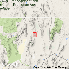
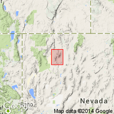
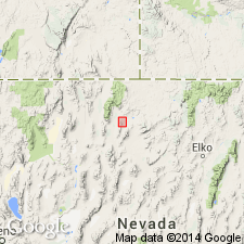
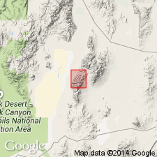
Happy Creek volcanic series exposed in Jackson Mountains and Pine Forest Range, Humboldt County, Nevada. Overlain by carbonate and clastic rocks of Permian and Triassic age in Jackson Mountains; Triassic age in Pine Forest Range; base not exposed. Age is Permian or older.
Source: GNU records (USGS DDS-6; Menlo GNULEX).
- Usage in publication:
-
- Happy Creek volcanic series*
- Modifications:
-
- Named
- AAPG geologic province:
-
- Great Basin province
Summary:
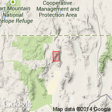
Named for exposures along Happy Creek in northern Jackson Mountains, Humboldt Co, Nevada [see Willden, 1964]; most extensive unit in range. Also crops out in Kings River Range and Pine Forest Range. Overlain by Permian and Triassic rocks; contact is gradational; base not exposed. Internal stratigraphy poorly known. Thickness unknown, but 20,000 ft not unreasonable. Primarily volcanics (mostly andesite) but some tuffs and graywacke; aphanitic to porphyritic. Host rock for iron deposition. Age is Permian or older; overlain by rocks containing Permian fossils. Possibly correlative with lower part of Koipato group; with basic volcanic rocks in Pablo formation in Toyabe Range; with marine Permian section at Black Rock, Nevada. [This paper was published before the "naming" paper of Willden (1964) which was referenced as Willden (1962, in press) where the name used was Happy Creek Group.]
Source: GNU records (USGS DDS-6; Menlo GNULEX).
- Usage in publication:
-
- Happy Creek Group*
- Modifications:
-
- Named
- Dominant lithology:
-
- Volcanics
- AAPG geologic province:
-
- Great Basin province
Summary:
Named for exposures along Happy Creek in northeast part of Jackson Mountains. Also extensively exposed in southern Pine Forest Range and small areas of southwest Kings River Range and south Black Rock Range. Base not exposed. Overlain by King Lear and Pansy Lee Formations in Jackson Mountains. Composed of massive aphanitic or porphyritic volcanic flows and flow-breccias, agglomerates, tuffs, and some graywacke; andesite to basalt in composition. Several thousand feet thick. Age is Permian or older; overlain by rocks with Permian fusulinids in Jackson Mountains. [Naming paper written in 1962 but not published until 1964 -after Willden, 1963, (USGS Bull. 1141-D) where name used was Happy Creek volcanic series. Unit not subdivided and therefore does not satisfy code for group status.]
Source: GNU records (USGS DDS-6; Menlo GNULEX).
- Usage in publication:
-
- Happy Creek Volcanics*
- Modifications:
-
- Revised
- AAPG geologic province:
-
- Great Basin province
Summary:
Name Happy Creek Volcanics used [Happy Creek Volcanics used instead of Happy Creek volcanic series in accordance with 1970 North American Stratigraphic Code]. Consists of breccia and lava (mostly pyroxene andesite and minor basalt and dacite) and an overlying unnamed unit of pillow lava and breccia, limestone, pelite, and volcanogenic clastic rocks. Unnamed unit contains Permian fusulinids. Formed within a magmatic arc. Correlative rocks contain Permian brachiopods. Related rocks, such as the Black Dyke Formation of Speed (1977), are recognized in the Mina area of west-central Nevada. [Note: name Happy Creek volcanic series used in Geologic map of Nevada by Stewart and Carlson (1978), but Happy Creek Volcanics is used in the accompanying text (this reference).]
Source: GNU records (USGS DDS-6; Menlo GNULEX).
- Usage in publication:
-
- Happy Creek Volcanic Complex*
- Modifications:
-
- Revised
- Age modified
- AAPG geologic province:
-
- Great Basin province
Summary:
Renamed Happy Creek Volcanic Complex (formerly Happy Creek Volcanics) in accordance with North American Stratigraphic Code; includes lavas, autobreccias, volcanic-flow breccias, intrusive rocks, and minor volcanogenic sedimentary rocks. Age is Triassic(?) and Jurassic based on 1) conformably overlies Boulder Creek beds which contain Late Triassic (Norian) radiolarians and 2) a whole rock Rb/Sr isochron age of 160 Ma.
Source: GNU records (USGS DDS-6; Menlo GNULEX).
- Usage in publication:
-
- Happy Creek Volcanic Complex*
- Modifications:
-
- Areal extent
- AAPG geologic province:
-
- Great Basin province
Summary:
Unit is geographically restricted from the report area based on stratigraphic relations showing its rocks are not equivalents of the Happy Creek Volcanic Complex in its type locality. Rocks are reassigned to an informal unit.
Source: GNU records (USGS DDS-6; Menlo GNULEX).

- Usage in publication:
-
- Happy Creek Volcanic Complex*
- Modifications:
-
- Age modified
- AAPG geologic province:
-
- Great Basin province
Summary:
Age of the Happy Creek Volcanic Complex is Late Triassic to Middle Jurassic.
Source: GNU records (USGS DDS-6; Menlo GNULEX).
For more information, please contact Nancy Stamm, Geologic Names Committee Secretary.
Asterisk (*) indicates published by U.S. Geological Survey authors.
"No current usage" (†) implies that a name has been abandoned or has fallen into disuse. Former usage and, if known, replacement name given in parentheses ( ).
Slash (/) indicates name conflicts with nomenclatural guidelines (CSN, 1933; ACSN, 1961, 1970; NACSN, 1983, 2005, 2021). May be explained within brackets ([ ]).