The National Geologic Map Database is migrating to a new infrastructure. We apologize for any service disruptions during this process.
|
|---|


- Usage in publication:
-
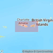
- Hans Lollik Formation
- Modifications:
-
- Overview
- Dominant lithology:
-
- Andesite
- AAPG geologic province:
-
- Caribbean region
Summary:
Hans Lollik Formation consists of waterlaid augite andesite pyroclastic rocks (bears strong resemblance to Louisenhoj Formation). Was called Hans Lollik augite andesite breccia member of Tortola Formation by Helsely (1960; Ph.D. thesis). Makes up the entire area of Hans Lollik and Little Hans Lollik Islands, where excellent although inaccessible and hazardous exposures occur on west sides of both islands. Only inferior exposures on eastern sides were examined. Thickness is at least 10,000 feet. Formation is moderately thermally metamorphosed, thus structure and mineralogy were difficult to determine. Age is Late Cretaceous.
Source: GNU records (USGS DDS-6; Reston GNULEX).
- Usage in publication:
-
- Hans Lollik Formation*
- Modifications:
-
- Overview
- AAPG geologic province:
-
- Caribbean region
Summary:
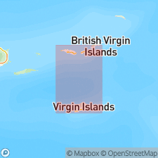
Author follows usage of Donnelly (1959, 1966) for the rocks on St. Thomas and St. John, VI. They include (ascending) the Early Cretaceous Water Island Formation and the Late Cretaceous Louisenhoj Formation, Outer Brass Limestone, Tutu Formation (with its informal Coki Point Megabreccia lithofacies and Congo Cay Limestone Member of Donnelly, 1959), and Hans Lollik Formation. Five felsic rocks from Water Island Formation, dated by Michael Diggles (U.S. Geological Survey) using K-Ar whole rock techniques, yielded a range from 65.8+/-2.9 to 30.9+/-0.3 Ma. Two rocks from Louisenhoj Formation also were dated using K-Ar techniques by Diggles and yielded a range from 42.1+/-0.6 to 37.7+/-1.1 Ma.
Source: GNU records (USGS DDS-6; Reston GNULEX).
For more information, please contact Nancy Stamm, Geologic Names Committee Secretary.
Asterisk (*) indicates published by U.S. Geological Survey authors.
"No current usage" (†) implies that a name has been abandoned or has fallen into disuse. Former usage and, if known, replacement name given in parentheses ( ).
Slash (/) indicates name conflicts with nomenclatural guidelines (CSN, 1933; ACSN, 1961, 1970; NACSN, 1983, 2005, 2021). May be explained within brackets ([ ]).