The National Geologic Map Database is migrating to a new infrastructure. We apologize for any service disruptions during this process.
|
|---|


- Usage in publication:
-
- Hanover limestone
- Modifications:
-
- Original reference
- AAPG geologic province:
-
- Basin-and-Range province
Summary:
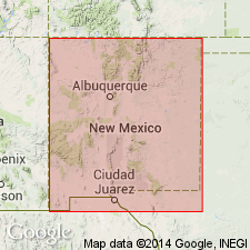
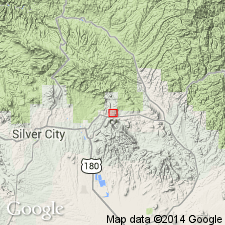
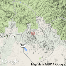
Hanover limestone. Crinoidal limestone forming top part of Lake Valley limestone in Central mining district or Santa Rita-Hanover-Fierro district, southwestern New Mexico. Because of deformation by the centrifugal peripheral thrust during intrusion of Hanover "stock" the Hanover limestone varies in thickness from 80 to 150 feet, the maximum measurement having been made at the crest and the minimum on a limb of the peripheral anticline. Average thickness in undisturbed areas 110 feet. No other formations in vicinity of Hanover are known to be greatly deformed. Age is Early Mississippian.
Source: US geologic names lexicon (USGS Bull. 896, p. 907).
- Usage in publication:
-
- Hanover limestone
- Modifications:
-
- Revised
- AAPG geologic province:
-
- Basin-and-Range province
Summary:
Pg. 780-781, pl. 2. Hanover limestone. Underlies Parting shale (new) in Pewabic Mine area, Hanover. Age is Early Mississippian.
Source: US geologic names lexicon (USGS Bull. 1200, p. 1665-1666).
- Usage in publication:
-
- Hanover limestone
- Modifications:
-
- Not used
- AAPG geologic province:
-
- Orogrande basin
Summary:
Pg. 7. Hanover limestone. Appears that Hanover as originally defined included both Kelly and top part of Lake Valley formation.
Source: US geologic names lexicon (USGS Bull. 1200, p. 1665-1666).
- Usage in publication:
-
- Hanover limestone
- Modifications:
-
- Revised
- AAPG geologic province:
-
- Basin-and-Range province
Summary:
Pg. 283 (fig. 5), 284. Hanover limestone in Lake Valley limestone. Lake Valley limestone divided into lower blue limestone and overlying crinoidal or Hanover limestone.
Source: US geologic names lexicon (USGS Bull. 1200, p. 1665-1666).
- Usage in publication:
-
- Hanover limestone
- Modifications:
-
- Not used
- AAPG geologic province:
-
- Basin-and-Range province
Jicha, H.L., Jr., and Lochman-Balk, Christina, 1958, Lexicon of New Mexico geologic names; Precambrian through Paleozoic: New Mexico Bureau of Mines and Mineral Resources Bulletin, no. 61, 137 p.
Summary:
Pg. 59. Hanover limestone. New Mexico Bureau of Mines and Mineral Resources recommends suppression of the name Hanover limestone.
Source: US geologic names lexicon (USGS Bull. 1200, p. 1665-1666).
For more information, please contact Nancy Stamm, Geologic Names Committee Secretary.
Asterisk (*) indicates published by U.S. Geological Survey authors.
"No current usage" (†) implies that a name has been abandoned or has fallen into disuse. Former usage and, if known, replacement name given in parentheses ( ).
Slash (/) indicates name conflicts with nomenclatural guidelines (CSN, 1933; ACSN, 1961, 1970; NACSN, 1983, 2005, 2021). May be explained within brackets ([ ]).