

- Usage in publication:
-
- Hamilton Reservoir Formation*
- Modifications:
-
- Named
- Dominant lithology:
-
- Schist
- Gneiss
- AAPG geologic province:
-
- New England province
Summary:
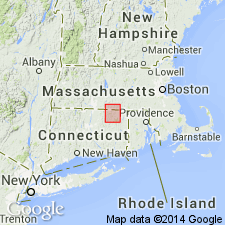
Named Hamilton Reservoir Formation of the Brimfield Group for exposures in low hills in vicinity of Hamilton Reservoir, Wales quadrangle, MA. Consists of 9200 m of rusty weathering schist with some gneiss. The unit is structurally separated into two parts by the Rock Meadow fault. The Hamilton Reservoir overlies the Bigelow Brook Formation of the Brimfield Group and underlies the Mount Pisgah Formation of the Brimfield Group. The unit is considered of Ordovician(?) to Early Devonian(?) age.
Source: GNU records (USGS DDS-6; Reston GNULEX).
- Usage in publication:
-
- Hamilton Reservoir Formation*
- Modifications:
-
- Geochronologic dating
- Age modified
- AAPG geologic province:
-
- New England province
Summary:
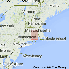
The age of the Brimfield Group and its Bigelow Brook, Hamilton Reservoir, and Mount Pisgah Formations in this area is considered to be Cambrian(?) based on the intrusion of 440 Ma Hedgehog Hill gneiss emplaced near the top of the Hamilton Reservoir Formation in the upper part of the Brimfield, although the top of the Brimfield, at least, may be Ordovician or older Paleozoic.
Source: GNU records (USGS DDS-6; Reston GNULEX).
- Usage in publication:
-
- Hamilton Reservoir Formation
- Modifications:
-
- Revised
- AAPG geologic province:
-
- New England province
Summary:
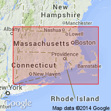
Rocks previously mapped as gneiss members interstratified with schists of the Hamilton Reservoir near Sturbridge, MA, are here informally named the Leadmine Pond Gneiss. The gneiss is interpreted in this report to be Precambrian(?) to Ordovician(?) basement unconformably underlying the Rangeley Formation.
Source: GNU records (USGS DDS-6; Reston GNULEX).
For more information, please contact Nancy Stamm, Geologic Names Committee Secretary.
Asterisk (*) indicates published by U.S. Geological Survey authors.
"No current usage" (†) implies that a name has been abandoned or has fallen into disuse. Former usage and, if known, replacement name given in parentheses ( ).
Slash (/) indicates name conflicts with nomenclatural guidelines (CSN, 1933; ACSN, 1961, 1970; NACSN, 1983, 2005, 2021). May be explained within brackets ([ ]).