

- Usage in publication:
-
- Hall Canyon member
- Modifications:
-
- Named
- Dominant lithology:
-
- Limestone
- AAPG geologic province:
-
- Great Basin province
- Wasatch uplift
Summary:
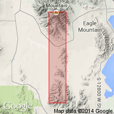
Named as the basal member of the Oquirrh formation for Hall Canyon and for exposures on contiguous ridges in the Oquirrh Mountains east of the town of Ophir, Tooele Co., UT in the Great Basin province. Type locality is in the eastern one-half of sec. 19, T 5 S, R 3 W. Section 915 ft thick measured in NE sec. 19. Consists of black, dark gray, and medium brown-gray (weathers medium gray), thin to massive, prominent ledge- and bench-forming bioclastic and crystalline limestone which can be argillaceous, cherty, and locally silty. Dark sooty gray to black shaly, thin bedded limestones and interbedded calcareous shale, brown coquina, and brown-weathering orthoquartzite at base. Basal units are transitional to the underlying Manning Canyon shale; the contact is arbitrary, especially where calcareous orthoquartzite (Hall Canyon) predominates over brown and black shale (Manning Canyon). Fossils (brachiopods, bryozoans, crinoids, corals) abundant (listed). Conformably underlies the newly named Meadow Canyon member of the Oquirrh. A massive cherty crystalline and bioclastic limestone commonly 40-50 ft thick, 94 ft thick at type locality, is the uppermost bed of the Hall Canyon. Geologic maps. Mapped in Utah Co. (Wasatch uplift) as well as in Tooele Co. Assigned a Morrowan age.
Source: GNU records (USGS DDS-6; Denver GNULEX).
For more information, please contact Nancy Stamm, Geologic Names Committee Secretary.
Asterisk (*) indicates published by U.S. Geological Survey authors.
"No current usage" (†) implies that a name has been abandoned or has fallen into disuse. Former usage and, if known, replacement name given in parentheses ( ).
Slash (/) indicates name conflicts with nomenclatural guidelines (CSN, 1933; ACSN, 1961, 1970; NACSN, 1983, 2005, 2021). May be explained within brackets ([ ]).