The National Geologic Map Database is migrating to a new infrastructure. We apologize for any service disruptions during this process.
|
|---|


- Usage in publication:
-
- Hailey conglomerate member
- Modifications:
-
- Original reference
- Dominant lithology:
-
- Conglomerate
- AAPG geologic province:
-
- Snake River basin
Summary:
Hailey conglomerate member of Wood River formation. Comprises gradation upward from immature graywackes to supermatare orthoquartzites. Thickness, 1,900 feet. Late Morrowan where it interfingers with limestones east of Muldoon trough; in the west, upper boundary is Desmoinesian. Older than Slate Creek member (new); overlies Muldoon formation (new).
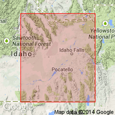
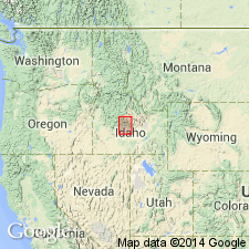
[Type locality not stated.] Deposited in Muldoon trough, aligned N. 30 deg. W., Bellevue area, ID.
Source: US geologic names lexicon (USGS Bull. 1200, p. 1645).
- Usage in publication:
-
- Hailey conglomerate member
- Modifications:
-
- Areal extent
- AAPG geologic province:
-
- Snake River basin
Summary:
Pg. 1427 (fig. 3). Hailey conglomerate member of Wood River formation. Correlation chart shows the Hailey at base of Wood River formation in Bellevue area, Idaho. Underlies unnamed lower sandy limestones of formation; unconformable above Milligen formation. Age is Pennsylvanian (Morrowan through Derryan).
Source: US geologic names lexicon (USGS Bull. 1200, p. 1645).
- Usage in publication:
-
- Hailey Conglomerate Member*
- Modifications:
-
- Adopted
- Dominant lithology:
-
- Conglomerate
- Limestone
- AAPG geologic province:
-
- Snake River basin
Summary:
Hailey Conglomerate Member of Wood River Formation. Hailey Conglomerate Member of Thomasson (1959a,b) adopted as lowermost (unit 1) of seven units of Wood River Formation. Thick-bedded or massive, chert pebble conglomerate, and brown, fine-grained, sandy limestone. Thickness 395 to 986 feet. Disconformably overlies Milligen Formation; conformably underlies unnamed unit 2. Fossiliferous (fusulinids, green algae). Age is considered Middle Pennsylvanian.
Type section: at west end of bridge over Big Wood River at Hailey, Blaine Co., south-central ID.
M.R. Thomasson, 1959a, Dissert. Abs., v. 20, no. 3, p. 999.
M.R. Thomasson, 1959b, Madison, Univ. Wisconsin, PhD thesis, 244 p.
Source: Changes in stratigraphic nomenclature, 1974 (USGS Bull. 1405-A, p. A10-A11); supplemental information from GNU records (USGS DDS-6; Denver GNULEX).
- Usage in publication:
-
- Hailey Conglomerate Member*
- Modifications:
-
- Areal extent
- AAPG geologic province:
-
- Idaho Mountains province
Summary:
Upward and eastward transport of Grand Prize Formation (a new name) over the Paleozoic Salmon River assemblage caused intense brecciation that formed a breccia as much as 300 m thick. This breccia was formerly assigned to Hailey Conglomerate Member of Wood River Formation at Slate Creek and Fourth of July Creek in the Boulder Mountains. Is of Middle Pennsylvanian age.
Source: GNU records (USGS DDS-6; Denver GNULEX).
- Usage in publication:
-
- Hailey Member*
- Modifications:
-
- Principal reference
- Revised
- Redescribed
- Dominant lithology:
-
- Conglomerate
- Limestone
- AAPG geologic province:
-
- Snake River basin
Summary:
Hailey Member of Wood River Formation. Revised to include the interfingering thin bioclastic limestone (= unit 2 of Hall and others, 1974). Consists of light-brown to light-gray conglomerate, 0 to 180 m thick, gradationally overlain by bluish-gray bioclastic limestone, 15 to 30 m thick. Total thickness 0 to 200 m. Correlates with lower members of Grand Prize and Dollarhide Formations of Sun Valley. Unconformably overlies Devonian Milligen Formation. Underlies Eagle Creek Member (new; = units 3, 4, 5, and 6 of Hall and others, 1974) of Wood River Formation; contact placed at first distinctive light purple micrite of the Eagle Creek. Age is Middle Pennsylvanian, based on fossils (corals, fusulinids, green algae).
Type section: lower 180m of the principal reference section east of Bellevue (Hall and others, 1974, p. 90; Section W5 of fig. 4).
Principal reference section: along ridge at Seamans Creek, in T. 3 N., R. 19 E., Blaine Co., ID.
Source: Publication; GNC index card files (USGS-Menlo); supplemental information from GNU records (USGS DDS-6; Denver GNULEX).
For more information, please contact Nancy Stamm, Geologic Names Committee Secretary.
Asterisk (*) indicates published by U.S. Geological Survey authors.
"No current usage" (†) implies that a name has been abandoned or has fallen into disuse. Former usage and, if known, replacement name given in parentheses ( ).
Slash (/) indicates name conflicts with nomenclatural guidelines (CSN, 1933; ACSN, 1961, 1970; NACSN, 1983, 2005, 2021). May be explained within brackets ([ ]).