The National Geologic Map Database is migrating to a new infrastructure. We apologize for any service disruptions during this process.
|
|---|


- Usage in publication:
-
- Hafey Mountain Member
- Modifications:
-
- Named
- Dominant lithology:
-
- Quartzite
- AAPG geologic province:
-
- New England province
Summary:
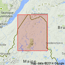
The "Hafey Mountain sequence" of Boudette and others (1976), underlying a narrow belt between Hafey Mountain and Rocky Mountain, is here named the Hafey Mountain Member of the Seboomook Formation. The member lies within the slate-graywacke sequence of the Seboomook at an unknown but apparently significant distance above the base of the formation. The quartz arenite (quartzite) of the Hafey Mountain is described by Boudette and others (1976) as resistant, massive, locally conglomeratic, orthoquartzite interbedded with minor laminated sandstone and gray siltstone. The orthoquartzite is brownish-gray, granular, and laced with quartz veins. Age is Early Devonian.
Source: GNU records (USGS DDS-6; Reston GNULEX).
- Usage in publication:
-
- Hafey Mountain Member
- Modifications:
-
- Overview
- Dominant lithology:
-
- Quartzite
- AAPG geologic province:
-
- New England province
Summary:
The Hafey Mountain Member of the Seboomook Formation is within the graywacke-rich portion of the formation and is 0 to 800 m thick. It appears to be well up in the section.
Source: GNU records (USGS DDS-6; Reston GNULEX).
For more information, please contact Nancy Stamm, Geologic Names Committee Secretary.
Asterisk (*) indicates published by U.S. Geological Survey authors.
"No current usage" (†) implies that a name has been abandoned or has fallen into disuse. Former usage and, if known, replacement name given in parentheses ( ).
Slash (/) indicates name conflicts with nomenclatural guidelines (CSN, 1933; ACSN, 1961, 1970; NACSN, 1983, 2005, 2021). May be explained within brackets ([ ]).