The National Geologic Map Database is migrating to a new infrastructure. We apologize for any service disruptions during this process.
|
|---|


- Usage in publication:
-
- Hadlyme Formation
- Modifications:
-
- First used
- AAPG geologic province:
-
- New England province
Summary:
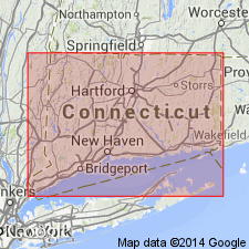
The rocks below 815 m in the Moodus research hole, CT, are correlated with the Late Proterozoic Waterford Group of the Avalon terrane, which is here called Waterford Complex and divided into the Hadlyme and Mamacoke Formations. [This is first use of Hadlyme as a formal name. Previously mapped as Hadlyme belt by Lundgren (1963) and gneiss of Hadlyme by Wintsch (1985) and Wintsch and Alelinikoff (1987).] Sequence is dominated by biotite- and hornblende-bearing plagioclase gneisses, but also contains thin layers of granitic gneiss, amphibolite, and pegmatite.
Source: GNU records (USGS DDS-6; Reston GNULEX).
- Usage in publication:
-
- Hadlyme Formation
- Modifications:
-
- Named
- Dominant lithology:
-
- Gneiss
- Amphibolite
- AAPG geologic province:
-
- New England province
Summary:
Hadlyme Formation of Waterford Complex here defined in the Avalon terrane of eastern CT to include three extrusive volcanic facies: North Plain, Jennings Pond, and Mansfield Hollow lithofacies. Term lithofacies, rather than member, used to convey vertical or chemical continuity, not lateral continuity. North Plain lithofacies (originally Hadlyme belt of Lundgren (1963)) described as a light- to medium-gray weathering plagioclase gneiss that forms most of the footwall of the Honey Hill fault. Jennings Pond lithofacies consists medium-gray-weathering plagioclase-quartz-biotite gneiss and dark gray to black amphibolite and lies between the Tatnic Hill or Hebron Formation and the North Plain lithofacies. Mansfield Hollow lithofacies is a light-gray-weathering plagioclase-quartz gneiss in the Willimantic area, similar to the North Plain.
Source: GNU records (USGS DDS-6; Reston GNULEX).
For more information, please contact Nancy Stamm, Geologic Names Committee Secretary.
Asterisk (*) indicates published by U.S. Geological Survey authors.
"No current usage" (†) implies that a name has been abandoned or has fallen into disuse. Former usage and, if known, replacement name given in parentheses ( ).
Slash (/) indicates name conflicts with nomenclatural guidelines (CSN, 1933; ACSN, 1961, 1970; NACSN, 1983, 2005, 2021). May be explained within brackets ([ ]).