The National Geologic Map Database is migrating to a new infrastructure. We apologize for any service disruptions during this process.
|
|---|


- Usage in publication:
-
- Hackberry shales
- Modifications:
-
- Original reference
- Dominant lithology:
-
- Shale
- AAPG geologic province:
-
- Anadarko basin
Summary:
Pg. 3, 46. Hackberry shales. Crumbling shales, chiefly maroon-colored, 0 to 20 feet thick, overlying Day Creek dolomite and underlying Big Basin sandstone. Included in Kiger division. Age is Permian (Cimarron).
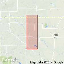
Named from Hackberry Creek, Clark Co., central southern KS.
Source: US geologic names lexicon (USGS Bull. 896, p. 894); GNC KS-NE Permian Corr. Chart, Oct. 1936.
- Usage in publication:
-
- Hackberry shale
- Modifications:
-
- Not used
- AAPG geologic province:
-
- Anadarko basin
Cragin, F.W., 1897, Observations on the Cimarron series: American Geologist, v. 19, p. 351-363.
Summary:
Pg. 362-363. Taloga formation is proposed to include Big Basin sandstone and Hackberry shale. [See under Taloga formation.]
Source: US geologic names lexicon (USGS Bull. 896, p. 894); GNC KS-NE Permian Corr. Chart, Oct. 1936.

- Usage in publication:
-
- Hackberry shale
- Modifications:
-
- Not used
- AAPG geologic province:
-
- Anadarko basin
Summary:
Hackberry shale of Cimarron group. The shale underlying Big Basin sandstone member of Greer formation has previously been called Hackberry shale, a name that is inapplicable because of prior use for an Upper Devonian division of Iowa.
[GNC remark (US geologic names lexicon, USGS Bull. 896, p. 894): There is no record of any other name having been introduced to replace this one.]
Source: US geologic names lexicon (USGS Bull. 896, p. 894).
For more information, please contact Nancy Stamm, Geologic Names Committee Secretary.
Asterisk (*) indicates published by U.S. Geological Survey authors.
"No current usage" (†) implies that a name has been abandoned or has fallen into disuse. Former usage and, if known, replacement name given in parentheses ( ).
Slash (/) indicates name conflicts with nomenclatural guidelines (CSN, 1933; ACSN, 1961, 1970; NACSN, 1983, 2005, 2021). May be explained within brackets ([ ]).