- Usage in publication:
-
- H T Butte lignite bed
- Modifications:
-
- First used
- Dominant lithology:
-
- Lignite
- AAPG geologic province:
-
- Williston basin
Summary:
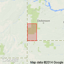
First used as the basal bed of the Sentinel Butte shale member of the Fort Union? formation in Slope, Billings, and Golden Valley Cos, ND in the Williston basin. Type not designated. Derivation of name not stated; apparently named for H T Butte, a conspicuous landmark in T134N, R102W, Slope Co, ND. Is mapped at H T Butte and elsewhere. Overlies Tongue River member of Fort Union formation. Lignite averages about 9 ft thick, but is over 16 ft thick. Has been largely eroded or burned out in Marmarth field, and occurs only as remnants. Is considered to be bed F of Sentinel Butte lignite group (Leonard and Smith, 1909) and probably bed R of Leonard (1908). Is correlated with bed K in the Sidney lignite field (Stebinger, 1912) and may correspond to the Roland coal bed of Taff (1909) in northern Wyoming. Age is Eocene.
Source: GNU records (USGS DDS-6; Denver GNULEX).
For more information, please contact Nancy Stamm, Geologic Names Committee Secretary.
Asterisk (*) indicates published by U.S. Geological Survey authors.
"No current usage" (†) implies that a name has been abandoned or has fallen into disuse. Former usage and, if known, replacement name given in parentheses ( ).
Slash (/) indicates name conflicts with nomenclatural guidelines (CSN, 1933; ACSN, 1961, 1970; NACSN, 1983, 2005, 2021). May be explained within brackets ([ ]).

