The National Geologic Map Database is migrating to a new infrastructure. We apologize for any service disruptions during this process.
|
|---|


- Usage in publication:
-
- Gypsum Creek Dolomite Bed
- Modifications:
-
- First used
- Dominant lithology:
-
- Dolomite
- AAPG geologic province:
-
- Palo Duro basin
- South Oklahoma folded belt
Summary:
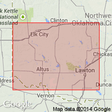
First published use as the basal bed of the Elm Fork Member (first used) of the Blaine Formation of the El Reno Group. Was named in an unpublished thesis. Overlies Flowerpot [Flower-pot] Shale. Underlies Haystack Gypsum Bed of Elm Fork. Type section (also called type locality) is just east of NW corner sec 26, T1S, R22W, Jackson Co, OK in the Palo Duro basin. Occurs in two separate areas--1) south flank of Anadarko basin along Kiowa-Washita Co line, and 2) southeast half of Hollis basin in Jackson Co (Palo Duro basin) and southern parts of Greer (S. Oklahoma folded belt province) and Harmon (Palo Duro basin) Cos. Consists of 0.3 ft of light gray microgranular, laminated platy dolomite with scattered particles of malachite at type. Measured section. Cross section. Permian age.
Source: GNU records (USGS DDS-6; Denver GNULEX).
For more information, please contact Nancy Stamm, Geologic Names Committee Secretary.
Asterisk (*) indicates published by U.S. Geological Survey authors.
"No current usage" (†) implies that a name has been abandoned or has fallen into disuse. Former usage and, if known, replacement name given in parentheses ( ).
Slash (/) indicates name conflicts with nomenclatural guidelines (CSN, 1933; ACSN, 1961, 1970; NACSN, 1983, 2005, 2021). May be explained within brackets ([ ]).