

- Usage in publication:
-
- Gurley [member]
- Modifications:
-
- Overview
- AAPG geologic province:
-
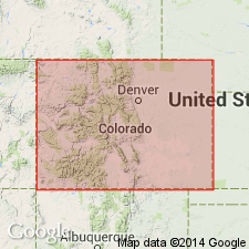
- Denver basin
Summary:
Is upper [member] (of three) in Omadi [formation] at top of Dakota group in the Denver basin in northeastern CO, southeastern WY, and western NE. Chart (Plate 3) illustrates various nomenclatures for the basin. Chart was part of a paper titled "The Denver-Cheyenne Basin," presented by C. W. Sternberg and A. J. Crowley at Los Angeles A.A.P.G. meeting March 1952. Is shown above Huntsman [member] and below Mowry [formation]. Gurley is shown correlative with "G" and "D" sands and an intervening unnamed unit; 2nd and 1st Dakota [sands] and an intervening unnamed unit; and with Upper Muddy.
Source: GNU records (USGS DDS-6; Denver GNULEX).
- Usage in publication:
-
- Gurley sandstone member
- Modifications:
-
- First used
- Overview
- Dominant lithology:
-
- Sandstone
- AAPG geologic province:
-
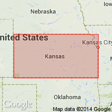
- Salina basin
- Central Kansas uplift
- Anadarko basin
- Las Animas arch
Summary:
First used as uppermost member of Omadi formation of Dakota group in subsurface of KS in Salina basin, Central Kansas uplift, Anadarko basin, and Las Animas arch. Overlies Huntsman shale member (new) of Omadi formation; underlies Upper Cretaceous Graneros shale of Colorado group. Consists of light-gray, fine- to medium-grained sandstone with subrounded quartz fragments and minor amounts of mica, glauconite, and pyrite; locally carbonaceous; may contain streaks of dark-gray to black shale, and locally sand is coarse grained and conglomeratic. Consists of two sandstones separated by shale unit in northwestern KS. Becomes more shaly to east and south. Thickness ranges from featheredge to about 120 ft. Is at least in part marine on basis of fossils. Is correlated with "D" and "G" sands of Denver basin. Is assigned to Gulfian Series (Upper Cretaceous). Derivation of name not given [perhaps named for Gurley, Cheyenne Co, NE].
Source: GNU records (USGS DDS-6; Denver GNULEX).
For more information, please contact Nancy Stamm, Geologic Names Committee Secretary.
Asterisk (*) indicates published by U.S. Geological Survey authors.
"No current usage" (†) implies that a name has been abandoned or has fallen into disuse. Former usage and, if known, replacement name given in parentheses ( ).
Slash (/) indicates name conflicts with nomenclatural guidelines (CSN, 1933; ACSN, 1961, 1970; NACSN, 1983, 2005, 2021). May be explained within brackets ([ ]).