The National Geologic Map Database is migrating to a new infrastructure. We apologize for any service disruptions during this process.
|
|---|


- Usage in publication:
-
- Gueydan formation
- Modifications:
-
- Original reference
- Dominant lithology:
-
- Tuff
- Clay
- Conglomerate
- AAPG geologic province:
-
- Gulf Coast basin
Summary:
(March 28, 1924.) p. 299-300. Gueydan formation. Consists of (descending): (1) brownish-pink latite or andesite tuff; (2) in places a bed of pink and green mottled massive bentonitic clay; (3) yellowish-white trachyte tuff; (4) at base a coarse conglomerate 20 feet thick. Unconformably underlies Oakville sandstone and unconformably overlies Frio formation. [Age is Oligocene or early Miocene.]
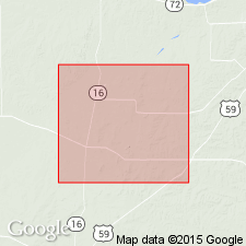
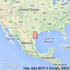
Named from exposures on Gueydan Ranch and survey, in southeastern part of McMullen Co., southern TX coastal plain.
Source: US geologic names lexicon (USGS Bull. 896, p. 888).
- Usage in publication:
-
- Gueydan formation
- Modifications:
-
- Principal reference
- Revised
- Dominant lithology:
-
- Tuff
- Clay
- Conglomerate
- AAPG geologic province:
-
- Gulf Coast basin
Summary:
Gueydan formation. Volcanic tuffs interbedded with fluviatile deposits which have been derived mainly from these tuffs. Occupies stratigraphic position between Frio clay (redefined by writer) and Oakville sandstone. Divided into 3 members, named (descending) Chusa member, Soledad member, and Fant member. Recognized in southern Texas Coastal Plain. [Age is Oligocene or early Miocene.]
Source: US geologic names lexicon (USGS Bull. 896, p. 888).

- Usage in publication:
-
- Gueydan formation†
- Modifications:
-
- Abandoned
- AAPG geologic province:
-
- Gulf Coast basin
Summary:
†Gueydan formation is same as Catahoula tuff; Catahoula has priority, and "Gueydan" has been discarded. [See also Discussion by T.L. Bailey, Mar. 1932, AAPG Bull., v. 16, no. 3, p. 259-260.]
Source: US geologic names lexicon (USGS Bull. 896, p. 888).
- Usage in publication:
-
- Gueydan ash member
- Modifications:
-
- Revised
- [Reinstated]
- AAPG geologic province:
-
- Gulf Coast basin
Summary:
Pg. 35. Referred to as Gueydan ash member of Catahoula formation in discussion of Fashing field area, Atascosa County, southern Texas. Overlaps entire Frio to southwest and to north has covered Upper Jackson lying on beds of Manning (Hockley shales) around Falls City. [Age is Oligocene or early Miocene.]
Source: US geologic names lexicon (USGS Bull. 1200, p. 1630).
- Usage in publication:
-
- Gueydan Formation
- Modifications:
-
- [Reinstated]
- AAPG geologic province:
-
- Gulf Coast basin
Summary:
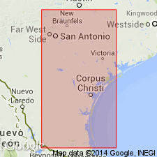
Gueydan (Catahoula) Formation. Gueydan Formation proposed by Bailey (1924) is preferred name for exposures between Rio Grande and Colorado River, Texas [notably in Duval, Gonzales, Karnes, Live Oak, McMullen, Starr, Webb, and Zapata Counties]. Term Catahoula introduced by Veatch (1905) for exposures in Catahoula Parish, Louisiana, and subsequently applied to strata similar either in lithology (in part) or in presumed age in east and south Texas.
Gueydan chiefly tuffaceous clay. Maximum thickness 1,100 feet (estimated). Within and south of Live Oak County, conformably overlies Oligocene(?) Frio Clay (Yeager Formation of Gardner and Trowbridge, 1931, and Murray, 1961). Contact placed at first prominent tuff bed above the Frio. North of Live Oak County, unconformably overlies Oligocene(?) Whitsett Formation of Jackson Group; contact is erosional surface. Unconformably underlies Miocene Oakville Formation or Pliocene Goliad Formation. Fossils (mostly redeposited). Age is possibly Oligocene to early Miocene, based on stratigraphic relations.
Source: Publication.
- Usage in publication:
-
- Gueydan Formation
- Modifications:
-
- Not used
- AAPG geologic province:
-
- Gulf Coast basin
Summary:
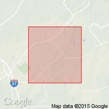
Pg. 4, 5, 9-16. [The Gueydan Formation as defined by Bailey (1926), recognized in Rio Grande embayment, Bee, Brooks, DeWitt, Duval, Goliad, Jim Hogg, Jim Wells, Karnes, Live Oak, McMullen, Starr, Webb Counties, Texas Coastal Plain, is = Catahoula Formation. Bailey's Chusa Tuff, Fant Tuff, and Soledad Conglomerate Members are transferred to the Catahoula.]
Source: Publication.
For more information, please contact Nancy Stamm, Geologic Names Committee Secretary.
Asterisk (*) indicates published by U.S. Geological Survey authors.
"No current usage" (†) implies that a name has been abandoned or has fallen into disuse. Former usage and, if known, replacement name given in parentheses ( ).
Slash (/) indicates name conflicts with nomenclatural guidelines (CSN, 1933; ACSN, 1961, 1970; NACSN, 1983, 2005, 2021). May be explained within brackets ([ ]).