The National Geologic Map Database is migrating to a new infrastructure. We apologize for any service disruptions during this process.
|
|---|


- Usage in publication:
-
- Guadalupian period*
- Modifications:
-
- Original reference
- AAPG geologic province:
-
- Permian basin
Summary:
Not only are these faunas very different from any known in America elsewhere, but they give evidence of being later in geologic time. For this reason I propose to give them a regional name, which shall be employed in a force similar to Mississippian and Pennsylvanian. For this none more appropriate that one derived from locality where they were first discovered can be found, and term Guadalupian is suggested. The stratigraphic limits of Guadalupian period will have to be determined on intrinsic evidence. At present it seems to include the whole section at southern end of Guadalupe Mountains, but the central fauna will be that of the "white" and "dark Permian" as described by Shumard. [The faunas to which name was applied were obtained from 1,700 to 1,800 feet of limestone (afterwards name Capitan limestone), underlain by 2,000 to 2,500 feet of yellow quartzose sandstone, underlain by 500 or more feet of thin-bedded basal limestone (now known as Bone Spring limestone) is, because of faunal and lithologic differences, now excluded from Delaware Mountain formation, with which it is unconformable, and therefore may not properly be a part of Guadalupe group, although included in original definition. At time "Guadalupian" was introduced the Bone Spring limestone had yielded only a few fossils. Age is Permian.]
Source: US geologic names lexicon (USGS Bull. 896, p. 884).
- Usage in publication:
-
- Guadalupian series
- Modifications:
-
- Revised
- AAPG geologic province:
-
- Permian basin
Girty, G.H., 1908, The Guadalupian fauna: U.S. Geological Survey Professional Paper, 58, 651 p.
Summary:
Pg. 10-11. Guadalupian series. Includes Capitan limestone and Delaware Mountain formation. Appears to be younger than Hueco formation. Overlying formation undetermined, being absent in Guadalupe Mountains. [Age is Permian.]
Source: US geologic names lexicon (USGS Bull. 896, p. 884).

- Usage in publication:
-
- Guadalupe group*
- Modifications:
-
- Overview
- AAPG geologic province:
-
- Permian basin
Summary:
Guadalupe group. Adopted by the USGS as a group term to include, originally, Capitan limestone and Delaware Mountain formation, which are characterized by unique fauna of Permian age. Now known to unconformably underlie Castile gypsum (also of Permian age), and considered to be in part younger and in part contemporaneous with beds that have been described as Hueco limestone. The Delaware Mountain formation of Delaware Mountains is now known to include in its upper part the time equivalent of Capitan limestone of Guadalupe Mountains. (See rpts. by P.B. King, 1934 (GSA Bull., v. 45, p. 697-793), and W.B. Lang, 1935 (AAPG Bull., v. 19, no. 2) and 1937 (AAPG Bull., v. 21, no. 7).)
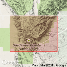
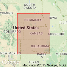
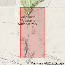
Named from Guadalupe Point, southern end of Guadalupe Mountains, El Paso Co., western TX.
Source: US geologic names lexicon (USGS Bull. 896, p. 884).
- Usage in publication:
-
- Guadalupe series
- Modifications:
-
- Principal reference
- Revised
- AAPG geologic province:
-
- Permian basin
Summary:
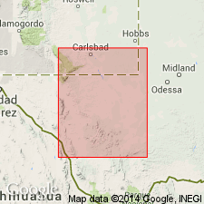
Pg. 1675-1676, 1678. Guadalupe series. Rank raised to series. Thickness 4,100 feet at type locality, south end of Guadalupe Mountains, El Paso County, western Texas; consists of 2,300 feet of sandstone overlain by 1,800 feet of (Capitan) limestone. Rests on Bone Spring limestone of Leonard age. Because of erosion, youngest beds of series missing from type section. Getty Oil Company's Dooley No. 7 in sec. 24, T. 20 S., E. 29 E., Eddy County, New Mexico, penetrated thickness of 5,250 feet. In Delaware basin, series represented by sandstone facies, Delaware Mountain sandstone, which is 3,000 to 3,500 feet ttick at outcrop in Delaware Mountains and is there divided into three approximately equal formations. Series in and around Delaware basin subdivided into two paleontologic units. Lower unit, which includes lower and middle formation of Delaware Mountain sandstone, the equivalent Word formation, and certain limestones of the marginal belt, contains ammonoid WAAGENOCERAS and is characterized by species of genus PARAFUSULINA more advanced than primitive genus of same species found in underlying Leonard series. Upper unit, which includes upper formation of Delaware Mountain and equivalent Capitan limestone, characterized by fusulind genus POLYDIEXODINA. Underlies Ochoa series (new). Includes Whitehorse group and equivalent beds in Texas, Oklahoma, and Kansas. Cimarron series of northern Midcontinent region should be abandoned and its strata reclassified as belonging to Leonard series and Guadalupe series.
Source: US geologic names lexicon (USGS Bull. 1200, p. 1625-1626).
- Usage in publication:
-
- Guadalupe series*
- Modifications:
-
- Revised
- AAPG geologic province:
-
- Permian basin
Summary:
Pg. 575-608, 699-709. Guadalupe series in Glass Mountains consists of Word formation below followed by a complex of deposits divided into Altuda formation, Capitan limestone, and Gilliam limestone. If this classification is correct, beds of late Guadalupe age in eastern Glass Mountains are much more restricted than they were thought to be in 1931, when they were supposed to include Vidrio, Gilliam, and Tessey limestones. The Tessey has been shown to be younger (King, 1938), and it is suggested herein that the Vidrio is older. Rocks of Guadalupe series in Delaware basin constitute Delaware Mountain group, composed dominantly of sandstone and divided into (ascending) Brushy Canyon, Cherry Canyon, and Bell Canyon formations. Away from basin, the sandstones tend to disappear. Their lower part passes out by overlap, and higher part is replaced by thick reef masses, Goat Seep and Capitan limestones. In shelf area, the reef masses grade into a complex of limestone, sandstone, and evaporite that forms Carlsbad and Chalk Bluff formations.
Source: US geologic names lexicon (USGS Bull. 1200, p. 1625-1626).

- Usage in publication:
-
- Guadalupian series*
- Modifications:
-
- Overview
- AAPG geologic province:
-
- Anadarko basin
- Las Animas arch
Summary:
Pg. 37. Rocks of Guadalupian series crop out in southern Kansas. They comprise unfossiliferous deposits that seem to have been laid down partly on land and partly in shallow basins occupied by strongly saline waters. Thickness of outcropping rocks of series about 290 feet. Subsurface thickness averages about 400 feet in southwestern part of state.
Source: US geologic names lexicon (USGS Bull. 1200, p. 1625-1626).

- Usage in publication:
-
- Guadalupian stage*
- Modifications:
-
- Overview
- AAPG geologic province:
-
- Anadarko basin
- Las Animas arch
Summary:
As shown on correlation chart, Guadalupian stage is Middle Permian.
Source: US geologic names lexicon (USGS Bull. 1200, p. 1625-1626).
- Usage in publication:
-
- Guadalupian series
- Modifications:
-
- Overview
- AAPG geologic province:
-
- Anadarko basin
- Palo Duro basin
Summary:
Pg. 233 (table 1). In Oklahoma, Guadalupian series includes El Reno and Whitehorse groups.
Source: US geologic names lexicon (USGS Bull. 1200, p. 1625-1626).
- Usage in publication:
-
- Guadalupe provincial series*
- Modifications:
-
- Revised
- AAPG geologic province:
-
- Permian basin
Summary:
Pg. 1578-1579. The USGS recognizes a two-fold subdivision of the Permian. Reference sequence for United States is designated as outcrops on northwestern Trans-Pecos Texas (Delaware Mountains, Guadalupe Mountains, and Sierra Diablo Mountains) where approximate faunal boundary is taken as that between Cherry Canyon and Bell Canyon formations which are encompassed by Guadalupe provincial series.
Source: US geologic names lexicon (USGS Bull. 1200, p. 1625-1626).
For more information, please contact Nancy Stamm, Geologic Names Committee Secretary.
Asterisk (*) indicates published by U.S. Geological Survey authors.
"No current usage" (†) implies that a name has been abandoned or has fallen into disuse. Former usage and, if known, replacement name given in parentheses ( ).
Slash (/) indicates name conflicts with nomenclatural guidelines (CSN, 1933; ACSN, 1961, 1970; NACSN, 1983, 2005, 2021). May be explained within brackets ([ ]).