The National Geologic Map Database is migrating to a new infrastructure. We apologize for any service disruptions during this process.
|
|---|


- Usage in publication:
-
- Grubstake Formation*
- Modifications:
-
- Named
- Biostratigraphic dating
- Dominant lithology:
-
- Claystone
- Sandstone
- Conglomerate
- Coal
- AAPG geologic province:
-
- Alaska East-Central region
- Alaska Southern region
Summary:
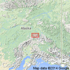
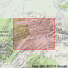
Type locality designated as exposures along east bank of Tatlanika Creek from mouth of Grubstake Creek to 1 mi south [secs.19,30 T10S R3W] Fairbanks A-3 quad, east-central AK. Reference section is 90 ft greenish-gray shale in upper part of section on Suntrana Creek, W/2 sec.23 T12S R7W, Healy D-4 quad. Appears to underlie 3 separate areas in Nenana coal field, northern foothills of Alaska Range. Includes interbedded dark claystone, dark sandstone, thin beds of coal and bone, and thick beds of fine white vitric ash. Is as thick as 1500 ft north of Coal Creek. Overlies with apparent conformity Lignite Creek Formation (new). Conformably and locally disconformably underlies Nenana Gravel. Age is provisionally set at late Miocene based on typical Homerian species SPIREA HOPKINSI. Apparent K-Ar age of 8.1 Ma on glass from Grubstake is not incompatible with late Miocene age for flora. Sketch map shows type locality and site of paleobotanical assemblage.
Source: GNU records (USGS DDS-6; Menlo GNULEX).
- Usage in publication:
-
- Grubstake Formation*
- Modifications:
-
- Revised
- AAPG geologic province:
-
- Alaska East-Central region
- Alaska Southern region
Summary:
Assigned as uppermost formation (of 5) in Usibelli Group (new). Radiometric age of 8.3 +/-0.4 Ma using new decay constants is considered late Miocene. Plant megafossils buried by ash fall are assigned late Homerian (late Miocene) age (Wolfe and Tanai, 1980). Grubstake represents blocking of southward drainage by beginning of growth of Alaska Range.
Source: GNU records (USGS DDS-6; Menlo GNULEX).
For more information, please contact Nancy Stamm, Geologic Names Committee Secretary.
Asterisk (*) indicates published by U.S. Geological Survey authors.
"No current usage" (†) implies that a name has been abandoned or has fallen into disuse. Former usage and, if known, replacement name given in parentheses ( ).
Slash (/) indicates name conflicts with nomenclatural guidelines (CSN, 1933; ACSN, 1961, 1970; NACSN, 1983, 2005, 2021). May be explained within brackets ([ ]).