The National Geologic Map Database is migrating to a new infrastructure. We apologize for any service disruptions during this process.
|
|---|


- Usage in publication:
-
- Grove limestone*
- Modifications:
-
- Original reference
- Dominant lithology:
-
- Limestone
- AAPG geologic province:
-
- Piedmont-Blue Ridge province
Summary:
Pg. 564-565. Grove limestone. The main quarry rock at Le Gore quarry [Frederick County, western Maryland]. Formerly erroneously called Beemantown limestone. Rests conformably on Frederick limestone. Is probably of Chazy or later age.
[Origin of name not stated in this publication, but authors stated orally that this limestone was named for Grove quarry and Grove Station, on Baltimore and Ohio RR, where it is well exposed in syncline above Frederick limestone. Age is Early Ordovician (Beekmantown). G.W. Stose and A.I. Jonas collected additional fossils from this formation which proved its early Beekmantown age.]
Source: US geologic names lexicon (USGS Bull. 896, p. 883).
- Usage in publication:
-
- Grove limestone*
- Modifications:
-
- Areal extent
- Dominant lithology:
-
- Limestone
- Dolomite
- AAPG geologic province:
-
- Piedmont-Blue Ridge province
Summary:
Pg. 43, 47-52, 84. Grove limestone. Thick-bedded high-calcium limestone with beds of massive dolomite in lower part and highly quartzose limestone at base. Thickness in quarry near LeGore, 590 feet. Overlies Frederick limestone; underlies New Oxford formation. Distribution noted. Age is Early Ordovician.
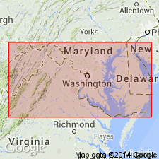
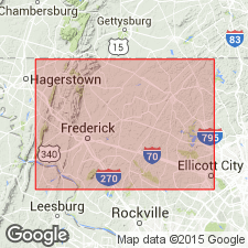
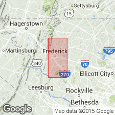
In middle of Frederick Valley, forms belt about 1 mi wide that extends from point south of Buckeystown northward to LeGore, where it is overlapped diagonally by Triassic sedimentary rocks; belt widens north of Fountain Rock, and at north end, west of Woodsboro, attains width of 2 mi; several narrower bands lie to west of main belt, and extend from south end of Chestnut Hill southwestward to U.S. Highway 40, west of Frederick, western MD.
Source: US geologic names lexicon (USGS Bull. 1200, p. 1623).
- Usage in publication:
-
- Grove Formation
- Modifications:
-
- Revised
- Biostratigraphic dating
- AAPG geologic province:
-
- Piedmont-Blue Ridge province
Summary:
Revised as Grove Formation in Frederick Valley syncline. Consists of limestones and dolomites. First appearance of abundant quartz sand above highly burrowed Lime Kiln Member (new) of Frederick Formation (revised) marks base of Grove. Basal quartz sand at base, suggested by Jonas and Stose (1936, 1938) was not recognized in Frederick Valley. Porous sand referred to by Jonas and Stose (1936) as weathered product of this basal zone is now thought to be Triassic in age and origin at all observed localities, although some sand may have been eroded from Grove Formation or from Rocky Springs Station Member of Frederick Formation. At type locality of Jonas and Stose (1936), the Grove Quarry on southeast edge of Frederick, MD, unit is approx 200 m thick, but top is not exposed. Maximum is 450 m farther north. Dominantly composed of thickly to massively bedded, light-gray limestones and white or buff dolomites which contain variable amounts of coarse quartz sand. Quartz sand and carbonate peloids render the Grove compositionally similar to Rocky Springs Station Member, though sedimentary structures and lithologic packaging are different. Previous work on trilobites, brachiopods, and cephalopods and recent work on conodonts (A. Epstein, 1973, oral commun.) all indicate an early Early Ordovician. Report includes geologic map and sections, geologic columns, measured sections, correlation charts, and fossil lists.
Source: GNU records (USGS DDS-6; Reston GNULEX).
- Usage in publication:
-
- Grove Formation*
- Modifications:
-
- Age modified
- Biostratigraphic dating
- AAPG geologic province:
-
- Piedmont-Blue Ridge province
Summary:
Grove Formation contains Upper Cambrian trilobite faunas in lower 30 m (M.E. Taylor, written commun., 1976) [see footnote to table 1; text of report still indicates Early Ordovician age.]. Overall age is Late Cambrian and Early Ordovician.
Source: GNU records (USGS DDS-6; Reston GNULEX).
For more information, please contact Nancy Stamm, Geologic Names Committee Secretary.
Asterisk (*) indicates published by U.S. Geological Survey authors.
"No current usage" (†) implies that a name has been abandoned or has fallen into disuse. Former usage and, if known, replacement name given in parentheses ( ).
Slash (/) indicates name conflicts with nomenclatural guidelines (CSN, 1933; ACSN, 1961, 1970; NACSN, 1983, 2005, 2021). May be explained within brackets ([ ]).