

- Usage in publication:
-
- Groesbeck Formation
- Modifications:
-
- Original reference
- Dominant lithology:
-
- Sand
- Gravel
- AAPG geologic province:
-
- Palo Duro basin
Summary:
Pg. 63-79. Groesbeck Formation. Consists largely of sands and gravels capped with gypsiferous clay. Thickness 17 feet at type locality. Sediments are of late Wisconsin age that accumulated in basin formed by solution of gypsum from underlying Blain [Blaine] Formation of the Lower Permian. Groesback Formation as well as Good Creek Formation (Dalquest, 1962) has been considered an outcrop of Seymour Formation (Cummins, 1893). Carbon-14 determinations date fauna 16,775 +/-565 years before present, correlating with Brady interstadial event.
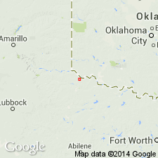
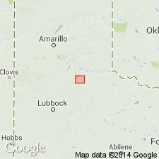
Type locality: locality mentioned by Cummins [1893] as the "Forks of Groesbeck Creek." Groesbeck Creek is small tributary of Red River, located near eastern side of Texas Panhandle, Hardeman Co.
Source: US geologic names lexicon (USGS Bull. 1350, p. 308-309).
- Usage in publication:
-
- Groesbeck Formation
- Modifications:
-
- Revised
- AAPG geologic province:
-
- Palo Duro basin
- Permian basin
Summary:
Newly assigned as one of three named formations and some unnamed lacustrine and palustrine rocks of the Paducah Group (named) in the eastern and southern Rolling Plains of TX, Palo Duro and Permian basins. Is younger than Good Creek Formation of Paducah Group and older than some unnamed lacustrine and palustrine deposits of the Paducah. Equivalent to middle part of newly named Lingos Formation of Paducah Group of the western and northern Rolling Plains. Geologic maps. Stratigraphic sections. Of Rancholabrean, late Pleistocene age. Stratigraphic chart.
Source: GNU records (USGS DDS-6; Denver GNULEX).
For more information, please contact Nancy Stamm, Geologic Names Committee Secretary.
Asterisk (*) indicates published by U.S. Geological Survey authors.
"No current usage" (†) implies that a name has been abandoned or has fallen into disuse. Former usage and, if known, replacement name given in parentheses ( ).
Slash (/) indicates name conflicts with nomenclatural guidelines (CSN, 1933; ACSN, 1961, 1970; NACSN, 1983, 2005, 2021). May be explained within brackets ([ ]).