- Usage in publication:
-
- Gringo Gulch Volcanics*
- Modifications:
-
- Named
- Dominant lithology:
-
- Volcanics
- AAPG geologic province:
-
- Basin-and-Range province
Summary:
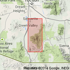
Named. Underlies southeastern part of Santa Rita Mountains. Extends into Patagonia Mountains. Type area is along Gringo Gulch 2-3 mi north-northwest of Patagonia in E1/2 W1/2 sec 25, T21S, R15E, Santa Cruz Co, AZ, Mount Wrightson quad. Is 1,500-2,000 ft thick. Lower member of dacitic lava, dacitic sandstone, conglomerate, and a little rhyolite lava and tuff. Some of the tuff is pale orange, indurated, and locally welded. Upper member tuff, tuffaceous sandstone, and a capping andesitic flow. A thin conspicuous bluish-gray welded tuff forms the base of upper member. Unconformably overlies rocks as young as Late Cretaceous Josephine Canyon Diorite. Intruded by upper? Oligocene dikes, Eocene? quartz veins and possibly by Paleocene porphyry. Is assigned to the Paleocene?
Source: GNU records (USGS DDS-6; Denver GNULEX).

- Usage in publication:
-
- Gringo Gulch Volcanics*
- Modifications:
-
- Overview
- AAPG geologic province:
-
- Basin-and-Range province
Summary:
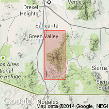
Lies unconformably on rocks as young as Salero Formation and Josephine Canyon Diorite of Late Cretaceous age. Underlies an area of 6 sq mi near Patagonia and probably an additional 4 sq mi beneath Quaternary cover. Extends into the Nogales quad, Pima and Santa Cruz Cos, AZ in the Basin-and-Range province. Divided into upper and lower members. Both members are mostly rhyolitic tuffs. The lower member is about 700 ft thick and has some dacitic flows and epiclastic rocks derived from dacitic volcanics, and local conglomerate lenses with dioritic clasts probably derived from the Josephine Canyon Diorite. The upper member about 900 ft thick is distinguished by basal bluish-gray, partly welded tuff and some andesitic flows. Deposited by airfall and fluvial processes. Lava flows and welded tuff sheets in southern and western parts of the area suggest south and west source. Is probably Paleocene age; deposited before about 55 m.y. ago. Geologic map of area near Patagonia shows these members and divisions of them.
Source: GNU records (USGS DDS-6; Denver GNULEX).

- Usage in publication:
-
- Gringo Gulch Volcanics*
- Modifications:
-
- Age modified
- AAPG geologic province:
-
- Basin-and-Range province
Summary:
Age of the Gringo Gulch Volcanics is Paleocene(?) based in part on isotopic ages of 62 +/-3 Ma (K-Ar; biotite) and 50 +/-10 Ma (Pb-alpha).
Source: GNU records (USGS DDS-6; Menlo GNULEX).
For more information, please contact Nancy Stamm, Geologic Names Committee Secretary.
Asterisk (*) indicates published by U.S. Geological Survey authors.
"No current usage" (†) implies that a name has been abandoned or has fallen into disuse. Former usage and, if known, replacement name given in parentheses ( ).
Slash (/) indicates name conflicts with nomenclatural guidelines (CSN, 1933; ACSN, 1961, 1970; NACSN, 1983, 2005, 2021). May be explained within brackets ([ ]).

