- Usage in publication:
-
- Grindstone Creek formation
- Modifications:
-
- Overview
- AAPG geologic province:
-
- Fort Worth syncline
Summary:
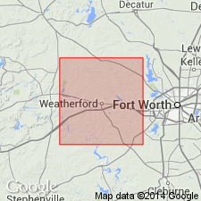
Pg. 18-20, fig. 3, pl. 4. Grindstone Creek formation. Chiefly a succession of shales, sandy shales, and sandstones occurring immediately above Brannon Bridge limestone [member of Lazy Bend formation]. Thickness about 450 feet. In this report [Parker County, north-central Texas], includes Santo limestone bed in about middle of formation and Goen limestone bed at top. Top of formation has been defined in Palo Pinto County (Plummer and Hornberger, 1936, Univ. Texas Bull., no. [3534]) as base of Thurber coal where present and top of Goen limestone where coal is missing. Thurber coal is missing in Parker County, and the Goen can be traced from Palo Pinto County only 0.5 mile eastward into Parker County; hence, in this report, boundary between Grindstone Creek and overlying Garner is mapped by projection of topographic and structural position of Goen limestone, but this method is considered unsatisfactory. Age is Pennsylvanian.
Source: US geologic names lexicon (USGS Bull. 1200, p. 1618-1619).
For more information, please contact Nancy Stamm, Geologic Names Committee Secretary.
Asterisk (*) indicates published by U.S. Geological Survey authors.
"No current usage" (†) implies that a name has been abandoned or has fallen into disuse. Former usage and, if known, replacement name given in parentheses ( ).
Slash (/) indicates name conflicts with nomenclatural guidelines (CSN, 1933; ACSN, 1961, 1970; NACSN, 1983, 2005, 2021). May be explained within brackets ([ ]).

