- Usage in publication:
-
- Grieve sand
- Modifications:
-
- Named
- Dominant lithology:
-
- Sandstone
- Shale
- AAPG geologic province:
-
- Wind River basin
Summary:
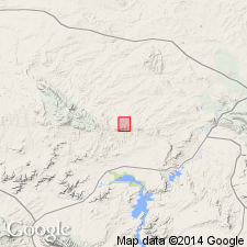
Named as an [informal?] subsurface lens at top of the Muddy Sandstone Member of Thermopolis Shale for the Grieve Field, Natrona Co, WY in the Wind River basin. No specific type well designated. Cross sections; areal extent map. Was included [but not distinguished] as part of the Muddy Sandstone Member of the Thermopolis in some earlier reports. Overlies Skull Creek Shale [Member] of the Thermopolis, a gradational, intertonguing to sharp contact. The Grieve is separated usually from the overlying Muddy Sandstone Member by a 4+ ft black, partly silty, shale. At one locality the Grieve is gradational into the lower part of Muddy. The lens consists of very fine to medium grained, well-sorted, subangular to subround, partly quartzitic sandstone, and minor black shale beds up to 13 ft thick, paper-thin carbonaceous shale and carbonized plant remains. A 6 inch to 1 ft thick calcite-cemented sand present at base. Can be nearly 100 ft thick. Isopach map of Grieve in T32N, R85W. Is a shallow water marine deposit with a northeast depositional trend. Fossils: spores, pollen, dinoflagellates, hystrichosphaerids. Cretaceous age.
Source: GNU records (USGS DDS-6; Denver GNULEX).
For more information, please contact Nancy Stamm, Geologic Names Committee Secretary.
Asterisk (*) indicates published by U.S. Geological Survey authors.
"No current usage" (†) implies that a name has been abandoned or has fallen into disuse. Former usage and, if known, replacement name given in parentheses ( ).
Slash (/) indicates name conflicts with nomenclatural guidelines (CSN, 1933; ACSN, 1961, 1970; NACSN, 1983, 2005, 2021). May be explained within brackets ([ ]).

