The National Geologic Map Database is migrating to a new infrastructure. We apologize for any service disruptions during this process.
|
|---|


- Usage in publication:
-
- Gregory zone
- Modifications:
-
- Named
- Dominant lithology:
-
- Shale
- Chalk
- Marl
- AAPG geologic province:
-
- Williston basin
- Sioux uplift
Summary:
Pg. 10-20, pls. 2, 3. Gregory zone of Sully member of Pierre formation. Includes all beds from top of Niobrara to base of Oacoma zone of Sully member (new) south of the Great Bend and, northward from this locality, all beds lying below Agency shale zone of Sully. At and near type locality, divisible into two lithologically and faunally distinct subdivisions. Lower consists of dark bentonite-bearing bituminous shales which contain fish scales. Upper is thin zone of chalk, chalky shale, argillaceous chalk, or marl. From vicinity of mouth of White River, Lyman County, to northernmost exposures near DeGrey, Hughes County, lower and upper Gregory are separated by thin but persistent sandstone bed. Thickness 12 to 145 feet. [Age is Cretaceous.]
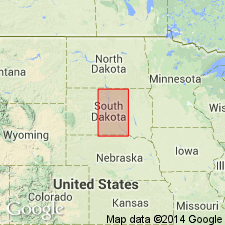
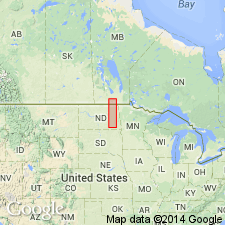
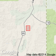
Type locality: outcrops along Missouri River in eastern Gregory Co. Well exposed in cut bank at south end of Rosebud Bridge, south of Wheeler. Also well exposed to east of Missouri River, especially south of U.S. Highway 18 in Charles Mix Co., central SD.
Source: US geologic names lexicon (USGS Bull. 1200, p. 1611-1612).
- Usage in publication:
-
- Gregory member
- Modifications:
-
- Revised
- Dominant lithology:
-
- Shale
- Marl
- AAPG geologic province:
-
- Williston basin
- Sioux uplift
Summary:
Pg. 8 (table 1), 11-14. Gregory member of Pierre shale. Name Gregory resurrected and used to include all beds between base of Gregory marl and base of upper calcareous zone herein named Crow Creek zone of Sully member. These beds form distinct lithologic unit in type locality and as far north as Hughes County, where they pass beneath river level. Overlies Sharon Springs member; underlies Sully member.
Source: US geologic names lexicon (USGS Bull. 896, p. 1611).
- Usage in publication:
-
- Gregory member*
- Modifications:
-
- Adopted
- AAPG geologic province:
-
- Sioux uplift
- Williston basin
Summary:
Pg. 2340 (table 1), 2346. Gregory member of Pierre shale. Underlies Crow Creek herein given member status in Pierre; overlies Sharon Springs member. Thickness at type section 34 feet. Consists of beds of light-gray to buff-colored shale with concretions and calcareous layers, and locally, as in Gregory County, basal marl beds. Gregory member as here adopted is Gregory member of Gries and Rothrock (1941, South Dakota Geol. Survey Rpt. Inv., no. 38, p. 8, table 1, 11-14), and greatly restricted Gregory member of Searight (1937, South Dakota Geol. Survey Rpt. Inv., no. 27, p. 10-20, pls. 2, 3). Age is Late Cretaceous.
[Type section (Searight, 1937): along Missouri River in cut bank at south end of Rosebud Bridge, south of Wheeler, in eastern Gregory Co., central SD. Also well exposed to east of Missouri River, especially south of U.S. Highway 18 in Charles Mix Co., central SD.]
Source: Publication; US geologic names lexicon (USGS Bull. 1200, p. 1611).
- Usage in publication:
-
- Gregory member*
- Modifications:
-
- Areal extent
- AAPG geologic province:
-
- Williston basin
- Chadron arch
Summary:
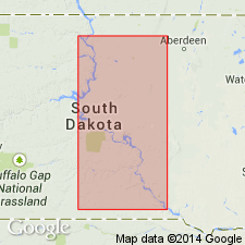
Gregory Member of Pierre Shale extended into southeastern flank of the Black Hills, in Fall River, Custer, Pennington, and Meade Counties, South Dakota, on Chadron arch and in Williston basin. Rocks formerly unnamed gray shale containing limestone and ferruginous concretions. Conformably overlies Sharon Springs Member of Pierre. Overlying rocks are not described. Age is Late Cretaceous.
Source: Modified from GNU records (USGS DDS-6; Denver GNULEX).
- Usage in publication:
-
- Gregory Member*
- Modifications:
-
- Areal extent
- Biostratigraphic dating
- AAPG geologic province:
-
- Williston basin
Summary:
Gregory Member of Pierre Shale extended into eastern North Dakota. Described from a section (reference section of Pierre Shale), near Little Yellowstone Park, Barnes County, North Dakota. There, is divisible into a lower 53 feet-thick unit of calcareous and non-calcareous shale containing yellowish-brown ironstone concretions, and an upper 55 feet-thick unit of marlstone. Is 24.5 feet thick in a reference section for Pierre (Pembina Mountain section), where it consists of alternate bands of light-colored calcareous claystone, darker colored non-calcareous shale, and thin beds of brown-weathering ironstone. Overlies Pembina Member of Pierre with a sharp contact; conformably underlies DeGrey Member of Pierre. At Valley City, Barnes County, North Dakota, is age-equivalent of Red Bird Member of Pierre Shale of the southern Black Hills, South Dakota and Wyoming. Lists Foraminifera and ammonites collected from the member. Shows ammonite zonation. Age is Late Cretaceous (Campanian).
Reference sections (for Pierre Shale): (1) near Little Yellowstone Park, about 20 mi south of Valley City, in sec. 31, T. 137 N., R. 57 W., and in secs. 35 and 36, T. 137 N., R. 58 W., Barnes Co., ND; (2) Pembina Mountain section, measured in sec. 24, T. 161 N., R. 57 W., Cavalier Co., ND.
Source: Modified from GNU records (USGS DDS-6; Denver GNULEX).
- Usage in publication:
-
- Gregory member*
- Modifications:
-
- Principal reference
- Dominant lithology:
-
- Shale
- AAPG geologic province:
-
- Sioux uplift
Schultz, L.G., 1965, Mineralogy and stratigraphy of the lower part of the Pierre Shale, South Dakota and Nebraska: U.S. Geological Survey Professional Paper, 392-B, p. B1-B19.
Summary:
Pg. B17, pl. 2. Gregory Member of Pierre Shale. Type section of Searight (1937) at Wheeler (Rosebud) Bridge is now submerged at normal water level by Fort Randall Reservoir. Therefore, section near mouth of Landing Creek is designated as a principal reference section. Consists of, descending: (1) medium-gray noncalcareous shale, contains siderite nodules and bentonite beds, 49.8 feet; (2) yellowish-gray marlstone, 0.4 feet; (3) medium-dark-gray, partly calcareous shale, 5 feet; (4) marlstone, 0.7 feet; (5) light-olive-gray, partly calcareous shale, 2.5 feet; and (6) two layers of light-gray limestone separated by 0.3-foot shale parting, 2.1 feet. Total thickness 60.5 feet. [=upper half of Searight's (1937) lower Gregory Member.] Underlies Crow Creek Member and overlies Sharon Springs Member; both of Pierre Shale. Fossils (pelecypods, cephalopods, gastropods, identified by W.A. Cobban, USGS). Age is Late Cretaceous.
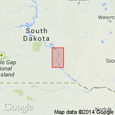
Principal reference section: Landing Creek section, in and above a large slumb scar southwest of mouth of Landing Creek, in NW/4 sec. 25, T. 100 N., R. 72 W., [Dixon 7.5-min quadrangle], Gregory Co., central southern SD. Named from Gregory County.
Reference locality: Chamberlain section, in and above first big roadcut north of U.S. Highway 16 at west end of highway bridge across Missouri River at Chamberlain, in NW/4 NE/4 sec. 17, T. 104 N., R. 71 W., Lyman Co., SD.
Source: Publication.
- Usage in publication:
-
- Gregory Member
- Modifications:
-
- Not used
Summary:
Not used on southern and eastern sides of the Black Hills, WY and SD, on Chadron arch and in Powder River and Williston basins. Rocks called Gregory Member of Pierre Shale by Kepferlee (1959) are referred to as Mitten Black Shale Member. Gregory Member of central and north-central SD correlates with Red Bird Silty Member, which overlies Mitten Black Shale Member in Fall River County, SD and Niobrara County, WY.
Source: GNU records (USGS DDS-6; Denver GNULEX).
For more information, please contact Nancy Stamm, Geologic Names Committee Secretary.
Asterisk (*) indicates published by U.S. Geological Survey authors.
"No current usage" (†) implies that a name has been abandoned or has fallen into disuse. Former usage and, if known, replacement name given in parentheses ( ).
Slash (/) indicates name conflicts with nomenclatural guidelines (CSN, 1933; ACSN, 1961, 1970; NACSN, 1983, 2005, 2021). May be explained within brackets ([ ]).