

- Usage in publication:
-
- Greggs breccia
- Modifications:
-
- Named
- Dominant lithology:
-
- Breccia
- AAPG geologic province:
-
- Plateau sedimentary province
Summary:
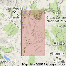
Named for Glenns Ferry, Mohave Co, AZ, in the Plateau sedimentary province. No type locality designated. Occurs in northwestern AZ. Is a detrital formation filling the Grand Wash Trough with an exposed thickness of about 1,400 ft. Consists of coarse, unassorted and poorly stratified material composed largely of blocks of crystalline rock. Toward the top the detrital material is cemented with lime carbonate; in places upper 200 ft consists of travertine with a few rock fragments. Travertine best exposed south of Colorado River and east of Greggs Ferry; caps conspicuous cliffs rising 1,400+ ft above the river. Unconformably underlies Temple Bar conglomerate (new); [underlying unit not given]. Geologic maps. Cross section. Age given as Tertiary "based largely on the physiographic evidence" of the Grand Wash Trough.
Source: GNU records (USGS DDS-6; Denver GNULEX).
For more information, please contact Nancy Stamm, Geologic Names Committee Secretary.
Asterisk (*) indicates published by U.S. Geological Survey authors.
"No current usage" (†) implies that a name has been abandoned or has fallen into disuse. Former usage and, if known, replacement name given in parentheses ( ).
Slash (/) indicates name conflicts with nomenclatural guidelines (CSN, 1933; ACSN, 1961, 1970; NACSN, 1983, 2005, 2021). May be explained within brackets ([ ]).