The National Geologic Map Database is migrating to a new infrastructure. We apologize for any service disruptions during this process.
|
|---|


- Usage in publication:
-
- Green River shales*
- Modifications:
-
- Named
- Dominant lithology:
-
- Shale
- AAPG geologic province:
-
- Green River basin
Summary:
Probably named for exposures along Green River in Sweetwater Co., WY in the Greater Green River basin. Starts east of Rock Spring Station. Composed of thinly laminated, chalky shales of purely fresh water origin. Layers are nearly horizontal and present a banded appearance. Has extensive flora and fauna (numerous insects and fish). Assigned a middle Tertiary age.
Source: GNU records (USGS DDS-6; Denver GNULEX).
- Usage in publication:
-
- Green River formation*
- Modifications:
-
- Revised
- AAPG geologic province:
-
- Green River basin
Summary:
Crops out along the sides of Rock Springs dome toward center of Green River basin, Sweetwater and Carbon Cos, WY in the Greater Green River basin. Extends south into Moffat Co, CO, also in the Greater Green River basin. Characterized by low dips. Four units recognized as part of Green. Two of these were previously assigned to the Wasatch formation. The four are equivalent to the Green River formation on the west side of the dome. Divided into (ascending order): the Tipton shale member (new, at base), Cathedral Bluffs red beds member (new), Laney shale member (new), and the plant beds and Tower sandstone of Powell. Powell's unit not studied, but author comments that it was not clearly defined. Unconformably underlies the Bridger formation. Unconformities separate the Cathedral Bluffs from the Laney, and the Laney from the plant beds and Tower. Ranges from 100 to 3,275 ft thick. Geologic map. Stratigraphic chart. Measured sections. Of Eocene age.
Source: GNU records (USGS DDS-6; Denver GNULEX).
- Usage in publication:
-
- Green River formation*
- Modifications:
-
- Revised
- AAPG geologic province:
-
- Green River basin
Summary:
Stratigraphic rank term of Tipton shale member of the Eocene Green River formation in Sweetwater Co, WY and adjoining Moffat Co, CO, Greater Green River basin, changed to Tipton tongue of Green River. The overlying Cathedral Bluffs which was formerly assigned to the Green River is reassigned as Cathedral Bluffs tongue of Wasatch formation. Laney shale member of Green River overlies and intertongues with Cathedral Bluffs. The Tipton is underlain by the main body of the Wasatch. The Laney is overlain by the Bridger. Cross section. Geologic map.
Source: GNU records (USGS DDS-6; Denver GNULEX).
- Usage in publication:
-
- Green River formation*
- Modifications:
-
- Revised
- AAPG geologic province:
-
- Green River basin
Summary:
Divided into: Tipton tongue, Laney shale member, and Morrow Creek member (new) in northern Sweetwater Co, WY in the Greater Green River basin. To south in Sweetwater Co, a sandstone that occurs between the Laney and the Morrow Creek is assigned to the Tower sandstone lentil (rank change from Tower sandstone). Measured sections; geologic maps; cross section. Of Eocene age.
Source: GNU records (USGS DDS-6; Denver GNULEX).
- Usage in publication:
-
- Green River formation*
- Modifications:
-
- Revised
- AAPG geologic province:
-
- Uinta basin
- Piceance basin
Summary:
Revised east of Bitter Creek, Ts12 and 13S, Rs22 and 23E, Uintah Co, UT in the Uinta basin; divisible into 4 newly named members--the Douglas Creek, Garden Gulch, Parachute Creek, and Evacuation Creek members. These names are used into Rio Blanco and Garfield Cos, CO in the Piceance basin. West of Bitter Creek into Duchesne Co, UT, is divisible into a basal member or a basal lacustrine phase separable into two parts by a tongue of the Wasatch, a delta facies, or oil-shale horizon, and a barren or saline or shaly facies. To north of White River in Moffat Co, CO in the Greater Green River basin, the Green River is represented by a shore and delta facies. This facies is equivalent to most of the formation south of the White River. The delta and shore facies is about 1,000 to 1,175 ft thick. Nearly 50 percent of this northern shore facies is a uniform gray-buff, soft, flaky, white, buff, gray to brown, fine or medium-grained sandstone with varicolored chert pebbles. Contains ostracods, gastropods, plant stem and leaf, crocodile, turtle, garpike and other fish bone and teeth fossils. Southward the shore facies grades into shore and delta facies and contains shale, oolite, marlstone, finer grained sandstone, paper-shale, and thin oil-shale beds. Is younger than Wasatch formation and older than Bridger formation. Of middle Eocene age. Geologic map. Cross section. Columnar sections.
Source: GNU records (USGS DDS-6; Denver GNULEX).
- Usage in publication:
-
- Green River formation
- Modifications:
-
- Areal extent
- AAPG geologic province:
-
- Uinta basin
Summary:
Pg. 120-121. Green River formation. Most of southern part of Uinta basin consists of outcrops of Green River formation. Varies in thickness; along Indian Canyon, exceeds 5,000 feet; farther east at Duchesne County line, about 1,800 feet present; at Colorado border 2,000 feet. Along north of Uinta basin, lower boundary of Green River is surface of overlap. From Asphalt Ridge, eastward along Rim Rock, beds unconformably overlie Mesaverde group. Throughout this distance, base of Green River rises stratigraphically until, at Raven Ridge, the Wasatch is exposed. On south side of Uinta basin, Green River shale overlies and interfingers with Colton formation (new). It also concordantly overlies Flagstaff limestone at north end of Wasatch Plateau. Throughout south and middle parts of Uinta basin, Green River strata are conformably overlain by Uinta formation. Part of unit herein termed Uinta(?) may be facies change of Green River formation similar to Cathedral Bluff tongue of northwestern Colorado. Age is Eocene.
Source: US geologic names lexicon (USGS Bull. 1200, p. 1604-1606).
- Usage in publication:
-
- Green River formation
- Modifications:
-
- Revised
- AAPG geologic province:
-
- Green River basin
Summary:
Divided in south-central Sublette Co, WY in the Greater Green River basin into the newly named Fontenelle member, Laney member, and the Morrow Creek member (which cannot be separated from the "lower" Bridger). The Fontenelle is separated from the Laney member by the newly named New Fork tongue of the Wasatch in the vicinity of the Green River-New Fork River junction. East of the junction, the New Fork pinches out and Laney rests on the Fontenelle. Geologic map; cross section. Of middle Eocene age.
Source: GNU records (USGS DDS-6; Denver GNULEX).
- Usage in publication:
-
- Green River formation*
- Modifications:
-
- Revised
- AAPG geologic province:
-
- Uinta basin
- Piceance basin
Summary:
Revised in that names Parachute Creek and Evacuation Creek members applied across area from Wasatch Co, UT east to Duchesne and Uintah Cos, UT in the Uinta basin, and into the Piceance basin of CO. The rocks west of Watson, in Uintah Co, were assigned to informally named parts of the Green River formation in earlier reports. Horse Bench sandstone bed thought to be recognizable across area in Evacuation Creek member about 175 ft above its base. Identification of Horse Bench in western sections is somewhat uncertain because the sandstone beds are discontinuous. This bed was formerly recognized as part of an unnamed upper part of the Green River. Cross section. Older parts of Green River not discussed. Conformably underlies Uinta formation. Of Eocene age.
Source: GNU records (USGS DDS-6; Denver GNULEX).
- Usage in publication:
-
- Green River formation*
- Modifications:
-
- Revised
- AAPG geologic province:
-
- Green River basin
Summary:
Pg. 100-103. Green River formation. Discussion of central part of Great Divide basin, Sweetwater County, Wyoming. The Green River comprises Luman tongue (new), Tipton tongue, Laney shale member, and Morrow Creek member. Intertongues with Wasatch formation. Battle Spring formation (new) intertongues with all parts of Wasatch and Green River formations except Laney shale member. In northern part of area, the Battle Spring replaces all parts of Wasatch and Green River formations except Morrow Creek member. Underlies Bridger formation. [Age is early to middle Eocene.]
Source: US geologic names lexicon (USGS Bull. 1200, p. 1604-1606).
- Usage in publication:
-
- Green River formation*
- Modifications:
-
- Revised
- AAPG geologic province:
-
- Green River basin
Summary:
Sequence in Green River formation in the Greater Green River basin of southwest WY formerly thought to be (ascending): Tipton tongue (or Tipton shale member), Laney shale member, and Morrow Creek member. This sequence revised to include (ascending): Tipton tongue and its equivalent Fontenelle tongue, the newly named Wilkins Peak member, and the Laney shale member. The name Wilkins Peak replaces local misapplication of name Laney to beds older than Laney in Green River. Term Morrow Creek abandoned because it was applied to rocks that belong to Laney. Term Tower sandstone changed to Tower sandstone lentil of Laney. Tower is not a coarse-grained sand; Tower is a uniformly fine grained crystal tuff. Formation assigned to the early and middle Eocene.
Source: GNU records (USGS DDS-6; Denver GNULEX).
- Usage in publication:
-
- Green River formation*
- Modifications:
-
- Revised
- AAPG geologic province:
-
- Piceance basin
Summary:
Is the major mapped unit (geologic map) of the report area, Garfield and Rio Blanco Cos, CO in the Piceance basin. Composed of dark shale and magnesian limestone that weather to gray, brown and white, a contrast in color to the underlying brightly colored Wasatch formation. Has a maximum thickness of 3,000 ft in northeast part of area. Divided into (ascending): Douglas Creek, Garden Gulch, Parachute Creek, and Evacuation Creek members in the western and southwestern parts of the basin from Fletcher Gulch on the northwest side to Parachute Creek on the southeast side. Between Parachute Creek to Piceance Creek on the east side of the basin, the lower part of the Green River equivalent to the Douglas Creek, Garden Gulch, and part of the Parachute Creek members is assigned to the newly named Anvil Points member. Cross sections. Eocene age.
Source: GNU records (USGS DDS-6; Denver GNULEX).
- Usage in publication:
-
- Green River formation*
- Modifications:
-
- Revised
- AAPG geologic province:
-
- Green River basin
Summary:
Divided into the Fontenelle tongue (restricted) at the base, the middle and upper tongues in the Fort Hill area, Lincoln Co, WY in the Greater Green River basin. The Fontenelle is restricted stratigraphically to the basal 50-60 ft of the original (Donovan, 1950) unit. The overlying strata of the original Fontenelle which are about 250 ft are reassigned to the New Fork tongue of the Green River formation. Of early Eocene age.
Source: GNU records (USGS DDS-6; Denver GNULEX).
- Usage in publication:
-
- Green River Formation*
- Modifications:
-
- Revised
- AAPG geologic province:
-
- Green River basin
Summary:
Name Tower Sandstone Lentil of Green River Formation has been applied to resistant lenticular sandstone and siltstone bodies that occur at many different horizons, mostly lower 400 ft, in the Laney Shale Member of Green River Formation of Eocene age, Sweetwater Co, WY in Greater Green River basin. Name Tower therefore abandoned.
Source: GNU records (USGS DDS-6; Denver GNULEX).
- Usage in publication:
-
- Green River Formation*
- Modifications:
-
- Revised
- AAPG geologic province:
-
- Green River basin
Summary:
Eocene Green River Formation intertongues westward with main body and conglomerate member of Wasatch Formation. The Fontenelle Tongue, basal unit of Green River, intertongues with La Barge Member (new name) of Wasatch in the Greater Green River basin of southwest WY.
Source: GNU records (USGS DDS-6; Denver GNULEX).
- Usage in publication:
-
- Green River Formation*
- Modifications:
-
- Revised
- AAPG geologic province:
-
- Green River basin
Summary:
Green River Formation revised in that the Firehole Bed named. Firehole replaces term "first tuff" of Wilkins Peak of Culbertson (1961). Green River divided in report area, Sweetwater Co, WY, Greater Green River basin, into (ascending): Laman Tongue, Tipton Shale, Wilkins Peak, and Laney Shale Members. The formation overlies Wasatch Formation and intertongues with Niland Tongue of Wasatch. Formation underlies Bridger Formation. Eocene age. Stratigraphic table; geologic map; measured section. Eocene age.
Source: GNU records (USGS DDS-6; Denver GNULEX).
- Usage in publication:
-
- Green River Formation
- Modifications:
-
- Revised
- AAPG geologic province:
-
- Piceance basin
- Green River basin
Summary:
Revised in that sandstone beds at base, in east part of Piceance basin formerly assigned to Douglas Creek Member of Green River Formation, renamed Piceance Creek Sandstone Tongue of Anvil Points Member of Green River. Reason for nomenclature change attributed to a change in source area. The Douglas Creek was derived from the west and southwest. The Anvil Points and Piceance Creek were derived from the east. Nomenclature chart. Areal extent map of Piceance Creek Member. Eocene age.
Source: GNU records (USGS DDS-6; Denver GNULEX).
- Usage in publication:
-
- Green River Formation
- Modifications:
-
- Revised
- AAPG geologic province:
-
- Green River basin
Summary:
Revised in that Ramsey Ranch assigned as lowermost member of Green River. Study area is in area of Rock Springs uplift, Greater Green River basin, WY. Green River consists of (ascending): Ramsey Ranch, Luman, Tipton Shale, Wilkins Peak, and Laney Shale Members. List of mollusks commonly found in Green River; chart showing previous nomenclature; restored section; map of areal extent of Ramsey Ranch, Luman, and Wilkins Peak. Eocene age.
Source: GNU records (USGS DDS-6; Denver GNULEX).
- Usage in publication:
-
- Green River Formation*
- Modifications:
-
- Revised
- AAPG geologic province:
-
- Piceance basin
Summary:
Overlies Shire Member, a new member of Wasatch Formation in southern Piceance basin. Assigned to the Eocene.
Source: GNU records (USGS DDS-6; Denver GNULEX).
- Usage in publication:
-
- Green River Formation
- Modifications:
-
- Revised
- AAPG geologic province:
-
- Wasatch uplift
Summary:
Green River Formation is about 5,800 ft thick in the Soldier Summit area of Utah Co, UT on the Wasatch uplift, where it can be divided into (ascending): Middle Fork Tongue (new name), Soldier Summit Member (new name), delta facies, Parachute Creek and Evacuation Creek Members. The Middle Fork (250-280 ft thick) and Soldier Summit (460 ft thick) are separated from each other by the Tabbyune Creek Tongue of the Colton Formation. Middle Fork and Soldier Summit are composed of shale, marlstone, and limestone. The delta facies is mostly gray-green marlstone interbedded with limestone, paper shale, and sandstone 3,250 ft thick. The Parachute Creek is mostly brownish-tan paper shale 630 ft thick. The Evacuation Creek contains brown calcareous shale, green shaly marlstone, limestone, and claystone 970 ft thick. The uppermost of four tuff beds is used as the top of the Evacuation Creek and of the Green River. Overlain by Uinta Formation. Measured sections of new units. Stratigraphic charts. Is a fluviatile unit of Eocene age.
Source: GNU records (USGS DDS-6; Denver GNULEX).
- Usage in publication:
-
- Green River Formation*
- Modifications:
-
- Revised
- AAPG geologic province:
-
- Green River basin
Summary:
Is still used in original sense for light-colored laminated calcareous beds between red-hued Wasatch Formation below and green-hued Bridge Formation above. Divided in Fossil basin of Greater Green River basin, Lincoln Co, WY, into Fossil Butte Member (new), the lower member, and Angelo Member (new), the upper member. Intertongues with sandstone and mudstone tongues of Wasatch. Generally overlies main body of Wasatch and underlies Bullpen Member (new) of Wasatch. Abundant well-preserved fossils from both members. Assigned a late early Eocene age. Of lacustrine origin. Measured sections.
Source: GNU records (USGS DDS-6; Denver GNULEX).
- Usage in publication:
-
- Green River Formation*
- Modifications:
-
- Revised
- AAPG geologic province:
-
- Green River basin
Summary:
Laney Shale Member changed to Laney Member and divided into the newly named LaClede Bed (base), Sand Butte Bed, and Hartt Cabin Bed (top) in the Washakie basin of the Greater Green River basin. Green River Formation represented only by Laney in this report. Laney intertongues with the underlying Cathedral Bluffs Tongue of Wasatch Formation. Hartt Cabin Bed of Laney intertongues with Kinney Rim Member of Washakie Formation on western exposures and unconformably underlies Adobe Town Member of Wasatch in the eastern exposures. Cross section. Correlation chart. Measured sections. E-log diagram of subsurface characteristics. Areal extent maps for each named bed. Is of Eocene age.
Source: GNU records (USGS DDS-6; Denver GNULEX).
- Usage in publication:
-
- Green River Formation*
- Modifications:
-
- Areal extent
- AAPG geologic province:
-
- Uinta basin
Summary:
Parachute Creek Member of Eocene Green River Formation extended from Piceance basin into Uinta basin. Name is applied to rocks formerly assigned to both Parachute Creek and overlying Evacuation Creek Members. Evacuation Creek Member abandoned.
Source: GNU records (USGS DDS-6; Denver GNULEX).
- Usage in publication:
-
- Green River Formation*
- Modifications:
-
- Revised
- AAPG geologic province:
-
- Piceance basin
Summary:
Four marlstone beds in the northern Piceance Creek basin (of the larger Piceance basin) named as tongues of Eocene Green River; these are (ascending): Yellow Creek, Dry Fork, Thirteenmile Creek, and Black Sulphur Tongues. These tongues intertongue with Uinta Formation and merge laterally within Parachute Creek Member of Green River. They are assigned to the Eocene.
Source: GNU records (USGS DDS-6; Denver GNULEX).
- Usage in publication:
-
- Green River Formation*
- Modifications:
-
- Revised
- AAPG geologic province:
-
- Piceance basin
Summary:
Some of the marlstone beds in the upper part of the Green River Formation are formally named. A distinctive stratigraphic marker in the upper part of the Green River Formation in the east-central and southern part of the Piceance basin in northwest CO is named Coughs Creek Tongue. Coughs Creek is overlain and underlain by Uinta Formation. Coughs Creek probably joined the main body of the Green River in the southern part of the Piceance basin but has since been eroded from that part of the basin. The newly named tongue is separated from the Parachute Creek Member of Green River by about 400 ft of the Uinta Formation. Cross section. Eocene age.
Source: GNU records (USGS DDS-6; Denver GNULEX).
- Usage in publication:
-
- Green River Formation*
- Modifications:
-
- Revised
- Age modified
- AAPG geologic province:
-
- Uinta basin
Summary:
Basal contact revised in Uinta basin to include Flagstaff Member (reduced in stratigraphic rank). Is continuous with Flagstaff central part of basin. However, Colton Formation separates Flagstaff from main part of Green River on north and south sides of basin. Is therefore of Paleocene and Eocene age.
Source: GNU records (USGS DDS-6; Denver GNULEX).
- Usage in publication:
-
- Green River Formation*
- Modifications:
-
- Revised
- AAPG geologic province:
-
- Piceance basin
Summary:
Includes the newly named Stewart Gulch Tongue, one of six marlstones in the upper part of the Green River that intertongues with Uinta Formation in the central and northern part of the Piceance basin. Assigned to the Eocene.
Source: GNU records (USGS DDS-6; Denver GNULEX).
- Usage in publication:
-
- Green River Formation
- Modifications:
-
- Revised
- AAPG geologic province:
-
- Green River basin
Summary:
Divided into Tipton Shale (base), Wilkins Peak, and Laney Members. Laney separable on west side of Greater Green River basin into newly named Craven Creek (base) and Cow Hollow (top) Beds by the upper tongue of Bridger Formation which is named Whiskey Butte Bed. Author recommends that name Tipton replace Fontenelle Tongue of Green River and that Fontenelle be "discarded." Of early and middle Eocene age.
Source: GNU records (USGS DDS-6; Denver GNULEX).
- Usage in publication:
-
- Green River Formation*
- Modifications:
-
- Revised
- AAPG geologic province:
-
- Piceance basin
Summary:
Three new units assigned to the Eocene Green River--1) Cow Ridge Member, formerly mapped as part of Douglas Creek Member and as part of Wasatch Formation, 2) Kimball Mountain Tuff Bed that is the basal bed of or a bed in the Douglas Creek and Parachute Creek Members, depending on locality, and 3) Long Point Bed that is the basal bed of Garden Gulch, Douglas Creek, and Anvil Points Members.
Source: GNU records (USGS DDS-6; Denver GNULEX).
- Usage in publication:
-
- Green River Formation*
- Modifications:
-
- Areal extent
- AAPG geologic province:
-
- Uinta basin
Summary:
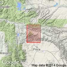
Flagstaff Member of the Green River Formation identified in Price Canyon (secs 21 and 15, T12S, R9E), Carbon Co., UT in the Uinta basin. Member rank used because Flagstaff is continuous with the Green River Formation in the subsurface.
Source: GNU records (USGS DDS-6; Denver GNULEX).
- Usage in publication:
-
- Green River Formation*
- Modifications:
-
- Revised
- AAPG geologic province:
-
- Green River basin
Summary:
Farson Sandstone Member of Green River Formation named in the western Greater Green River basin. Rocks assigned to Farson have been included in the Tipton Shale Member of Green River by Bradley and in New Fork Tongue of Wasatch Formation by Culbertson. Term New Fork not used. The Tipton Shale Member of the Green River is divided into the newly named Scheggs Bed at base and the newly named Rife Bed at top. Stratigraphic diagrams. Of early and middle Eocene age; early Eocene perissodactyls found in main body of Wasatch 95 ft below base of Scheggs in sec 25, T24N, R101W; LAMBDOTHERIUM and CYNODONTOMYS found 8 ft below top of Farson in sec 25, T25N, R102W; CORYPHODON, PHENACODUS, HYRACOTHERIUM, HEPTODON, LAMBDOTHERIUM found at type section of Farson; HYRACOTHERIUM found near Cathedral Bluffs Tongue-Wilkins Peak Member contact in sec 24, T12N, R99W.
A 160 to 375 ft thick unit that was mapped as the gray zone at the top of the Wasatch Formation in Moffat Co, CO, as an unnamed tongue at the base of the Laney Member of the Green River Formation in adjoining WY, and as intertongued Laney and Cathedral Bluffs unit, is renamed Godiva Rim Member of Green River Formation. The new member overlies Cathedral Bluffs Tongue of Wasatch and underlies LaClede Bed of Laney Member of Green River Formation. Ranges in age from early to middle Eocene. Cross section.
Source: GNU records (USGS DDS-6; Denver GNULEX).
- Usage in publication:
-
- Green River Formation*
- Modifications:
-
- Areal extent
- Dominant lithology:
-
- Marlstone
- AAPG geologic province:
-
- Piceance basin
Summary:
Is an Eocene formation in central Roan Plateau area in south-central part of Piceance Creek basin, northwestern CO. [Piceance Creek basin is generally defined as smaller Tertiary oil-shale basin within Piceance basin.] Consists almost entirely of rocks of lacustrine origin, and is divided into four members (ascending): westward-thinning Anvil Points Member, mostly near-shore freshwater lacustrine kerogen-rich fissile shale, and fine-grained sandstone; Garden Gulch Member, freshwater lacustrine gray to brown dolomitic shale and claystone, and lesser fissile clay shale; Douglas Creek Member, near-shore freshwater lacustrine silty dolomitic shale and claystone, clay shale, and lesser siltstone, sandstone, oil shale, and algal limestone; and Parachute Creek Member, mostly dolomitic marlstone, much of which is oil shale, and lesser clay shale, siltstone and sandstone, and several very thin altered tuff beds. Correlation of informal oil-shale units. Demonstrates complex intertongued nature of Green River and Uinta Formations, particularly regarding lithostratigraphic equivalents of parts of Parachute Creek Member. Much of Uinta consists of southward-thinning wedges of clastic rocks that interfinger with northward-thinning marlstone tongues of Green River. Marlstone units include (ascending): Coughs Creek and Stewart Gulch Tongues; marlstone at Barnes Ridge; marker bed at Bull Fork; and marlstones at Jackrabbit Ridge, Sleepy Ridge, Skinner Ridge.
Source: GNU records (USGS DDS-6; Denver GNULEX).
- Usage in publication:
-
- Green River Formation
- Modifications:
-
- Areal extent
- AAPG geologic province:
-
- Uinta basin
Summary:
Study area within Carbon and Duchesne Cos, UT, Uinta basin. Main body of Green River divided into lower part and upper member; lower part subdivided into (ascending) carbonate marker unit, Sunnyside delta interval, and transitional interval. At Nine Mile Canyon carbonate marker unit, which marks base of Eocene part of Green River, is a 130 m-thick interval representing deposits along fluctuating southern shore of ancient Lake Uinta; Sunnyside delta interval, named for Sunnyside tar sand deposit on Roan Cliffs, is a 375 m-thick sequence representing deposits in large fluvially-dominated delta system along southern shore of Lake Uinta; transitional interval is a 200-m-thick sequence representing marginal-to open-lacustrine deposits; and upper member is a 325 m-thick interval of relatively low energy, open-lacustrine deposits formed when Lake Uinta was at its maximum size. Upper member contains stratigraphic markers including Mahogany oil-shale bed, S2 marker bed, Horse Bench Sandstone Bed, and an upper tuff. Chart 1 compares nomenclature of previous workers. Seventeen measured sections. Figure 5 summarizes published paleontological data and isotopic and zircon fission-track dates, which suggest ages of 54 Ma, 47.5 Ma, and 43 Ma for base of carbonate marker unit, top of transitional interval, and top of upper member, respectively . Thus main body of Green River is late early to late middle Eocene (middle Wasatchian to late Uintan) age.
Source: GNU records (USGS DDS-6; Denver GNULEX).
- Usage in publication:
-
- Green River Formation*
- Modifications:
-
- Areal extent
- AAPG geologic province:
-
- Green River basin
Summary:
Isopach maps of Luman Tongue, Farson Sandstone Member, Scheggs and Rife Beds of Tipton Shale Member, Wilkins Peak Member, Godiva Rim Member, and LaClede and Sand Butte Beds of Laney Member within Greater Green River basin, WY and CO. Luman reaches maximum thickness of 455 ft in southwest Washakie basin. Farson is 400 ft thick near Farson, WY, Green River basin. Scheggs attains a thickness of 300 ft in southwest Washakie and in western Sand Wash basins. Rife is locally more than 200 ft thick in parts of Green River, Washakie and Great Divide basins. Wilkins Peak is divided into lower, middle, and upper parts; locally thickness of lower part is 200 ft in southern Green River basin and in southwest Washakie basin; middle part, generally restricted to Green River basin and Rock Springs uplift areas, reaches its maximum thickness of 800 ft in area of Uinta Mountain trough; upper part reaches maximum thickness of 100 ft in central and southern Green River basin and in southwest Washakie and west Sand Wash basins. Godiva Rim reaches maximum thickness of 350 ft in southern Sand Wash basin. LaClede has maximum thickness of 800 ft near eastern end of Uinta Mountains. Sand Butte is restricted to flanks of Rock Springs uplift and parts of adjacent basin; thickness ranges from 0-850 ft. Stratigraphic chart; cross sections. Eocene age.
Source: GNU records (USGS DDS-6; Denver GNULEX).
- Usage in publication:
-
- Green River Formation*
- Modifications:
-
- Revised
- AAPG geologic province:
-
- Uinta basin
Summary:
In eastern Uinta basin is divided into (ascending) Cow Ridge and Douglas Creek Members, clay-rich sequence, and Parachute Creek Member. Clay-rich sequence is basinward equivalent of part of Douglas Creek (fig. 3). Rocks of clay-rich sequence are brown, thinly laminate (flaky on outcrop), and commonly contain abundant flattened ostracods on bedding planes; contains few carbonate beds and is, in general, less kerogenous than overlying Parachute Creek Member of Green River. Sequence is lithologically similar to Garden Gulch Member of Green River in Piceance Creek basin, but exact temporal relationship has not been determined. No diagnostic fossils or isotopic ages have been obtained from sequence. Near principal depositional axis of Green River in eastern Uinta Basin, underlies Parachute Creek; overlies Douglas Creek Member of Green River. Middle Eocene age is assumed based on stratigraphic relationship of Douglas Creek and clay-rich sequence.
Source: GNU records (USGS DDS-6; Denver GNULEX).
For more information, please contact Nancy Stamm, Geologic Names Committee Secretary.
Asterisk (*) indicates published by U.S. Geological Survey authors.
"No current usage" (†) implies that a name has been abandoned or has fallen into disuse. Former usage and, if known, replacement name given in parentheses ( ).
Slash (/) indicates name conflicts with nomenclatural guidelines (CSN, 1933; ACSN, 1961, 1970; NACSN, 1983, 2005, 2021). May be explained within brackets ([ ]).