The National Geologic Map Database is migrating to a new infrastructure. We apologize for any service disruptions during this process.
|
|---|


- Usage in publication:
-
- Green Ravine Formation*
- Modifications:
-
- Biostratigraphic dating
- AAPG geologic province:
-
- Great Basin province
Summary:
Pg. A40-A42. Green Ravine Formation in the Rogers Canyon sequence, northern Oquirrh Mountains, Tooele County, Utah. Can be separated into three parts biostratigraphically: a pre-CANINA Zone part containing a predominantly bryozoan-brachiopod fauna and locally a number of small mollusks; the CANINA Zone with corals and chaetetiform bryozoans predominant; and a post-CANINA Zone part populated mainly by brachiopods. In southern Wasatch Range and in the Bingham sequence in the southern part of the Oquirrh Mountains, the CANINA zone lies within the Great Blue Limestone. Age is Late Mississippian (Chester).
Source: Publication.
- Usage in publication:
-
- Green Ravine Formation*
- Modifications:
-
- Original reference
- Dominant lithology:
-
- Limestone
- Shale
- AAPG geologic province:
-
- Great Basin province
Summary:
Pg. A10-A11. Green Ravine Formation. Lower part dominantly 1- to 2-foot thick, gray, locally fossiliferous limestone beds and black and gray shale layers. Upper part consists of medium-bedded to massive, 2- to 3-foot thick, medium-gray, locally fossiliferous limestone and banded nodular black cherty limestone at base, and interbedded medium- to thick-bedded, fossiliferous limestone and thin- to medium-bedded, argillaceous, fossiliferous limestone at top. Total thickness uncertain because base is concealed; 1,400+ feet exposed at type section. Is part of Rogers Canyon sequence. Conformably underlies Lake Point Limestone of Oquirrh Group. Fossils (brachiopods, corals, bryozoans identified by Mackenzie Gordon, Jr., and H.M. Duncan, USGS; see section on biostratigraphy and correlation, p. A38-A70). Age is Late Mississippian (Chesterian), based on fossils (pre-CANINIA zone, bryozoan-brachiopod fauna; CANINIA zone, corals and chaetetiform byrozoans; post-CANINIA zone, brachiopods).
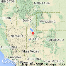
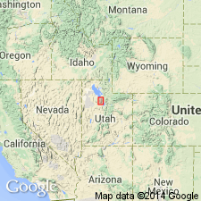
Type section: exposures near the mouth of Green Ravine, in SE/4 sec. 1, T. 2 S., R. 4 W., and NW/4 sec. 6, T. 2 S., R. 3 W., west side of Kessler Peak, northern Oquirrh Mountains, Garfield quadrangle, Tooele Co., north-central UT. Named from Green Ravine.
Source: Publication; US geologic names lexicon (USGS Bull. 1520, p. 124); Changes in stratigraphic nomenclature, 1970 (USGS Bull. 1354-A, p. A10-A11).
For more information, please contact Nancy Stamm, Geologic Names Committee Secretary.
Asterisk (*) indicates published by U.S. Geological Survey authors.
"No current usage" (†) implies that a name has been abandoned or has fallen into disuse. Former usage and, if known, replacement name given in parentheses ( ).
Slash (/) indicates name conflicts with nomenclatural guidelines (CSN, 1933; ACSN, 1961, 1970; NACSN, 1983, 2005, 2021). May be explained within brackets ([ ]).