

- Usage in publication:
-
- Green Gulch volcanics*
- Modifications:
-
- Named
- Dominant lithology:
-
- Basalt
- Andesite
- Phyllite
- AAPG geologic province:
-
- Southwestern Basin-and-Range region
Summary:
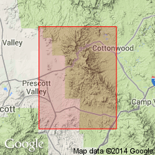
Is named as formation of Alder group of Yavapai series for exposures along Green Gulch in southeastern part of Prescott quad, AZ, Southwestern Basin-and-Range region. No type locality designated. Present in southwest corner of Jerome area. Bounded by Chaparral fault. Extends beyond map area. Covered to north by Cenozoic rocks. Comprises dark-gray, basaltic and andesitic flows and gray to black tuffaceous rocks that range from phyllite to more massive and coarser grained rocks. Relict pillow and breccia structures, amygdules, vesicles, and bedding preserved locally in flows. Tuffaceous rocks range from rhyolitic to basaltic, and range from finely laminated to massive, and locally coarser grained. A few lithic pebbles, mostly of rhyolite, present locally. The thickness and stratigraphic relations are unknown. Neither top nor bottom exposed. Is older Precambrian. Geologic map.
Source: GNU records (USGS DDS-6; Denver GNULEX).
- Usage in publication:
-
- Green Gulch Volcanics*
- Modifications:
-
- Revised
- AAPG geologic province:
-
- Southwestern Basin-and-Range region
Summary:
Is removed from the abandoned Alder Group. Is basal formation of newly named Big Bug Group. Is present in Prescott, Mount Union, and Mingus Mountain quads, Yavapai Co, AZ in the Southwestern Basin-and-Range region. Consists of an eastern unit of basaltic flows and a western unit of rhyolitic flows, rhyolitic and andesitic tuffaceous rocks. Prevalence of west-facing flows suggests that rhyolitic flows overlie the basalt. Some formerly unnamed volcanic rocks of Alder Group are known to be part of Green Gulch and are so assigned in this report. Probably 7,000 ft maximum thickness. Geologic map. Of Precambrian age.
Source: GNU records (USGS DDS-6; Denver GNULEX).
For more information, please contact Nancy Stamm, Geologic Names Committee Secretary.
Asterisk (*) indicates published by U.S. Geological Survey authors.
"No current usage" (†) implies that a name has been abandoned or has fallen into disuse. Former usage and, if known, replacement name given in parentheses ( ).
Slash (/) indicates name conflicts with nomenclatural guidelines (CSN, 1933; ACSN, 1961, 1970; NACSN, 1983, 2005, 2021). May be explained within brackets ([ ]).