- Usage in publication:
-
- Graydon formation
- Modifications:
-
- Overview
- Dominant lithology:
-
- Conglomerate
- Sandstone
- AAPG geologic province:
-
- Ozark uplift
- Lincoln anticline
Summary:
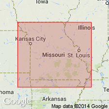
Used as Graydon formation of Cherokee group. Occupies same interval in Cherokee as conglomerate and sandstone named Graydon by Winslow (1894) in southwestern MO and used by Branson (1941, Guidebook for Kansas Geological Society field trip) at Fulton in Callaway Co., northeastern MO. Excellent exposures 1) in deep cuts along US Hwy 50 in Cave Hill locality, NE1/4NW1/4 sec. 14, T43N, R6W, east of Mount Sterling, Gasconade Co.; 2) in Forbes pit, NW1/4NE1/4NW1/4, sec. 35, T38N, R8W, just north of Rolla, Phelps Co.; 3) junction of US Hwys 63 and 66 at north edge of Rolla; 4) on eastbound side of US Hwy 66 toward St. James; 5) on northbound side of US Hwy 63 toward Vichy; 6) along St. Louis-San Francisco RR between Rolla and St. James; and 7) between northeastern Rolla and Rolla Municipal Airport some 2 mi east. Basal portion consists of porous, white, gray, green, red, and purple chert conglomerate and lenses of fine-grained, hard, locally quartzitic sandstone; also contains fairly well rounded boulders of hard, glassy, fossiliferous Devonian quartzite. Thickness of basal portion reaches a maximum of 125 ft. Overlying conglomerate with either sharp or gradational contact is soft, friable, and fine-grained sandstone; thickness ranges from 20 to 75 ft. It forms "rim-rock" of sink-hole-type clay deposits. Report includes stratigraphic sections. Age is Pennsylvanian.
Source: GNU records (USGS DDS-6; Reston GNULEX).
For more information, please contact Nancy Stamm, Geologic Names Committee Secretary.
Asterisk (*) indicates published by U.S. Geological Survey authors.
"No current usage" (†) implies that a name has been abandoned or has fallen into disuse. Former usage and, if known, replacement name given in parentheses ( ).
Slash (/) indicates name conflicts with nomenclatural guidelines (CSN, 1933; ACSN, 1961, 1970; NACSN, 1983, 2005, 2021). May be explained within brackets ([ ]).

