

- Usage in publication:
-
- Grayback Mountain rhyolite tuff*
- Modifications:
-
- Named
- Dominant lithology:
-
- Tuff
- AAPG geologic province:
-
- Basin-and-Range province
Summary:
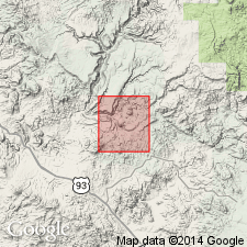
Named for exposures on Grayback Mountain, southwest corner of geologic map, Bagdad area, Yavapai Co, AZ, Basin-and-Range province. No type locality designated. Underlies summit of Grayback Mountain. Covers an area of less than one-half sq mi. Is massive, thick bedded, irregular in thickness due to fact that it rests on an erosion surface and is eroded at top. About 500 ft exposed in some sections. Has fragmental texture--fragments are lithic rhyolite, flow-banded rhyolite, and alaskite porphyry of lapilli size. Pyroclastic texture proves it to be a tuff. Rests on Yavapai series. Is younger than several unnamed igneous rocks of Late Cretaceous? or early Tertiary age. Assigned to Late Cretaceous? or early Tertiary.
Source: GNU records (USGS DDS-6; Denver GNULEX).
For more information, please contact Nancy Stamm, Geologic Names Committee Secretary.
Asterisk (*) indicates published by U.S. Geological Survey authors.
"No current usage" (†) implies that a name has been abandoned or has fallen into disuse. Former usage and, if known, replacement name given in parentheses ( ).
Slash (/) indicates name conflicts with nomenclatural guidelines (CSN, 1933; ACSN, 1961, 1970; NACSN, 1983, 2005, 2021). May be explained within brackets ([ ]).