- Usage in publication:
-
- Gray Hills Rhyolite Member*
- Modifications:
-
- Named
- Dominant lithology:
-
- Rhyolite
- AAPG geologic province:
-
- Wasatch uplift
Summary:
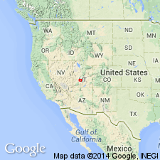
Named as a member of Mount Belknap Volcanics for flows in highest parts of the Gray Hills (its type area), Piute Co, UT on the Wasatch uplift. Its distribution and the type area are coextensive. Was called Gray Hills Rhyolite by Malloy and Kerr in earlier reports. Is made up of thick rhyolite flows with prominent contorted layers. Phenocrysts are sparse, and the flows are characterized by devitrification spherulites and thin lenticular gas cavities lined with euhedral vapor-phase crystals of quartz and sanidine. Is 700 m or more thick. Is part of the sequence in the eastern source area and an outflow facies associated with the Red Hills caldera. Is younger than the Red Hills Tuff Member; is older than the upper gray tuff member. Assigned to the Miocene.
Source: GNU records (USGS DDS-6; Denver GNULEX).
For more information, please contact Nancy Stamm, Geologic Names Committee Secretary.
Asterisk (*) indicates published by U.S. Geological Survey authors.
"No current usage" (†) implies that a name has been abandoned or has fallen into disuse. Former usage and, if known, replacement name given in parentheses ( ).
Slash (/) indicates name conflicts with nomenclatural guidelines (CSN, 1933; ACSN, 1961, 1970; NACSN, 1983, 2005, 2021). May be explained within brackets ([ ]).

