

- Usage in publication:
-
- Gravel Creek sand member
- Modifications:
-
- Named
- Dominant lithology:
-
- Sand
- Gravel
- AAPG geologic province:
-
- Mid-Gulf Coast basin
Summary:
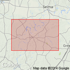
Named the Gravel Creek sand member of the Nanafalia formation for Gravel Creek, 7.1 mi south of Camden, Wilcox Co., AL. Consists of white to yellow, medium- to coarse-grained, cross-bedded sand with lenses of fine gravel and clay pebbles. Thickness is 2 to 80 ft (47 ft thick at type locality). Unit is generally unfossiliferous. The Gravel Creek unconformably overlies the Coal Bluff member of the Naheola formation and underlies an unnamed middle member of the Nanafalia. The Gravel Creek sand member is of early Eocene age.
Source: GNU records (USGS DDS-6; Reston GNULEX).

- Usage in publication:
-
- Gravel Creek Sand Member
- Modifications:
-
- Overview
- AAPG geologic province:
-
- Mid-Gulf Coast basin
Summary:
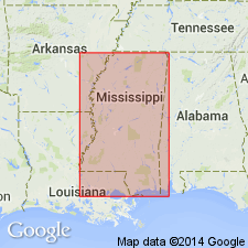
Gravel Creek Sand Member at the base of the Nanafalia Formation consists of fine- to coarse-grained cross-bedded sand containing fine quartz gravel, clay pebbles, and thinly laminated beds of carbonaceous clay and silt. Outliers occur far north of normal outcrop area. Unconformably underlies the middle informal member --the "OSTREA THIRSAE beds"; unconformably overlies the Coal Bluff Marl Member of the Naheola Formation. Age is Paleocene (Sabinian).
Source: GNU records (USGS DDS-6; Reston GNULEX).
- Usage in publication:
-
- Gravel Creek Member
- Modifications:
-
- Areal extent
- AAPG geologic province:
-
- Mid-Gulf Coast basin
Summary:
Authors state, " * * * Gravel Creek Sand Member [of the Nanafalia Formation] thickens westward into Mississippi at the expense of the underlying Naheola Formation."
Source: GNU records (USGS DDS-6; Reston GNULEX).
For more information, please contact Nancy Stamm, Geologic Names Committee Secretary.
Asterisk (*) indicates published by U.S. Geological Survey authors.
"No current usage" (†) implies that a name has been abandoned or has fallen into disuse. Former usage and, if known, replacement name given in parentheses ( ).
Slash (/) indicates name conflicts with nomenclatural guidelines (CSN, 1933; ACSN, 1961, 1970; NACSN, 1983, 2005, 2021). May be explained within brackets ([ ]).