The National Geologic Map Database is migrating to a new infrastructure. We apologize for any service disruptions during this process.
|
|---|


- Usage in publication:
-
- Grassy member
- Modifications:
-
- Named
- Dominant lithology:
-
- Sandstone
- AAPG geologic province:
-
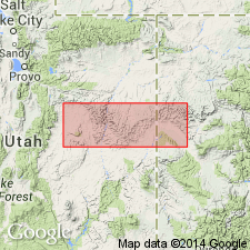
- Paradox basin
Summary:
Named as one of six members of Blackhawk Formation for exposures in cliffs east of railroad siding of Grassy, T17N, R14E, Emery Co, UT in the Paradox basin. No type locality designated. Overlies Sunnyside member (new) of Blackhawk and underlies Desert member (new) of Blackhawk. Consists of a basal littoral marine sandstone about 60 ft thick that is medium grained and buff, and a series of coal-bearing rocks [no further lithologic description] about 50 ft thick. Between Green River and Coal Canyon, three offshore bar sandstones form the east limit of the coal-bearing unit; member identified in cross section only at these localities. Late Cretaceous age.
Source: GNU records (USGS DDS-6; Denver GNULEX).
For more information, please contact Nancy Stamm, Geologic Names Committee Secretary.
Asterisk (*) indicates published by U.S. Geological Survey authors.
"No current usage" (†) implies that a name has been abandoned or has fallen into disuse. Former usage and, if known, replacement name given in parentheses ( ).
Slash (/) indicates name conflicts with nomenclatural guidelines (CSN, 1933; ACSN, 1961, 1970; NACSN, 1983, 2005, 2021). May be explained within brackets ([ ]).