

- Usage in publication:
-
- Grassy Mountain ignimbrite
- Modifications:
-
- Named
- Dominant lithology:
-
- Ignimbrite
- AAPG geologic province:
-
- Midcontinent region
Summary:
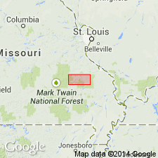
Named as an informal field term for typical exposures on Grassy Mountain, for which unit is named, Iron Co, MO, Midcontinent region. Exposed in north-central, central and southern part of quad. Weathered outcrops are generally low relief and locally have columnar jointing. Fresh samples of ignimbrite contain prominent phenocrysts of quartz and reddish alkali feldspar in black to very dark-maroon matrix; weathered surfaces are gray with many visible quartz and feldspar phenocrysts; pumice fragments are not common, though when present are weathered to pinkish color and thus stand out. Thickness varies from place to place; is about 300 m thick in northern part of quad; thickens to south where it may be as thick as 1,000-2,000 m. Unconformably underlies Pilot Knob felsite; overlies Lake Killarney unit (new, informal). Petrographic description; generalized geologic map. Replaces in part Pilot Knob felsite and Stouts Creek Rhyolite as mapped by Tolman and Robertson (1969). Precambrian age.
Source: GNU records (USGS DDS-6; Denver GNULEX).
- Usage in publication:
-
- Grassy Mountain Ignimbrite*
- Modifications:
-
- Areal extent
- Revised
- AAPG geologic province:
-
- Midcontinent region
Summary:
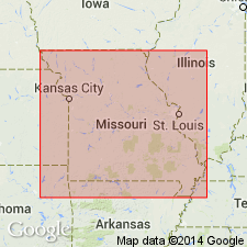
Revised to formal unit [though not specifically stated] because it is distinctive, easily recognizable and widespread. Grassy Mountain is extended beyond Lake Killarney quad [where it was defined as an informal field term by Sides (1976)], northward to Simms Mountain area northeast of Bismarck, St. Francois Co and southward to Patterson Mountain area, about 10 mi south-southeast of Ironton, in Iron and Madison Cos; megascopically identical rocks also occur in isolated outcrops west of Caledonia, Washington Co and east of Fredericktown, Madison Co and a larger mass underlies an area of 12 sq mi northwest of Fredericktown, all in southeast MO, Midcontinent region. Thus remnants of unit occur over an area of about 450 sq mi. Replaces part of Stouts Creek Rhyolite at west end of Stouts Creek Shut-ins. Precambrian age.
Source: GNU records (USGS DDS-6; Denver GNULEX).
- Usage in publication:
-
- Grassy Mountain Ignimbrite
- Modifications:
-
- Revised
- AAPG geologic province:
-
- Midcontinent region
Summary:
Grassy Mountain Ignimbrite, middle formation (of 3) of /Butler Hill Group of /St. Francois Mountains Volcanic Supergroup (revised). Study area is St. Francois Mountains, southeast Missouri (Midcontinent region). Younger than Lake Killarney Formation (revised) of Butler Hill; older than Pilot Knob Felsite (revised) of Butler Hill. Age is Precambrian Y. Nomenclature listed in table 1.
[Conflicts with nomenclature guidelines (ACSN, 1970; NACSN, 1983, 2005, 2021): name Butler Hill applied concurrently to two different units in same area; preempted by Butler Hill Granite of Tolman and Robertson (1969); name St. Francois Mountains applied concurrently to two different units in same area; a [supergroup] name combines a geographic name with the term ["supergroup,"] and no lithic designation is included.]
Source: Modified from GNU records (USGS DDS-6; Denver GNULEX).
- Usage in publication:
-
- Grassy Mountain Ignimbrite
- Modifications:
-
- Areal extent
- Overview
- AAPG geologic province:
-
- Midcontinent region
Summary:
In Ketcherside Mountain area of St. Francois Mountains, southeast MO, Midcontinent region, rocks previously mapped as Stouts Creek Rhyolite (not used) by Tolman and Robertson (1969) are here mapped as Grassy Mountain Ignimbrite and as informal Ketcherside Mountain ignimbrite. Thickness of Grassy Mountain is about 1000 m (ranging from 280-1580 m) and is exposed over an area of 32 sq km, thus, its minimum volume is 32 cu km. The combined original volume of Grassy Mountain and Taum Sauk Rhyolite was probably over 100 cu km which corresponds to ash-flow tuffs produced from calderas elsewhere as reported by other workers. Grassy Mountain was produced by Butler Hill caldera in eastern St. Francois Mountains and Taum Sauk was produced by Taum Sauk caldera in western St. Francois Mountains. Geologic map (fig. 3). Table 1 shows comparison of nomenclature with previous workers. Oldest mapped unit in area though overlies (probably conformably) Lake Killarney Formation; underlies with angular unconformity an unnamed quartz bearing rhyolite. St. Francois Mountains igneous rocks are about 1500 m.y. old (Precambrian).
Source: GNU records (USGS DDS-6; Denver GNULEX).
- Usage in publication:
-
- Grassy Mountain ignimbrite
- Modifications:
-
- Overview
- Revised
- AAPG geologic province:
-
- Midcontinent region
Summary:
Mapped in eastern St. Francois Mountains, Midcontinent region. [Not clear if authors intended stratigraphic units within study area to be formal or informal.] Unit is at least 1000 m thick on Kelley Mountain, in southeast part of Lake Killarney quad. Some important features of unit are: 1) its distinctive lithology consisting of abundant phenocrysts of quartz and salmon-colored perthite in dark-maroon to black matrix (crushed pumice fragments are generally quite rare, although are locally abundant); 2) its lithologic uniformity throughout its thickness; and 3) its matrix is everywhere granular and does not show well-developed eutaxitic texture that characterizes many of thinner ash flow tuffs higher in section. Table of stratigraphic units; geologic map. Younger than Lake Killarney formation (revised); older than Iron Mountain Lake felsite (first used). Most volcanic rocks of St. Francois Mountains are 1485 m.y. old (Proterozoic).
[Authors' intentions are unclear as to which, if any, of the geologic units discussed should have formal status.]
Source: GNU records (USGS DDS-6; Denver GNULEX).
- Usage in publication:
-
- Grassy Mountain Ignimbrite
- Modifications:
-
- Overview
- AAPG geologic province:
-
- Midcontinent region
Summary:
Mapped (fig. 1) in parts of Iron Mountain Lake and Graniteville quads, central St. Francois Mountains, MO, Midcontinent region. Occurs north, east, and southeast of regional angular unconformity. (Rocks east and north of unconformity are older than rocks west of it). Consists of thin locally developed crystal-depleted base and thick (500 m) cooling unit. Contains perthitic alkali feldspar and quartz and rare Fe-Ti oxides and altered remnants of biotite and hornblende. Chemically similar to Butler Hill Granite and is thought to be outflow unit for Butler Hill caldera. Petrologic data. Younger than Lake Killarney Formation; older than Stono Granite. Proterozoic age (1440-1480 Ma).
Source: GNU records (USGS DDS-6; Denver GNULEX).
For more information, please contact Nancy Stamm, Geologic Names Committee Secretary.
Asterisk (*) indicates published by U.S. Geological Survey authors.
"No current usage" (†) implies that a name has been abandoned or has fallen into disuse. Former usage and, if known, replacement name given in parentheses ( ).
Slash (/) indicates name conflicts with nomenclatural guidelines (CSN, 1933; ACSN, 1961, 1970; NACSN, 1983, 2005, 2021). May be explained within brackets ([ ]).