The National Geologic Map Database is migrating to a new infrastructure. We apologize for any service disruptions during this process.
|
|---|


- Usage in publication:
-
- Grassy Knob chert
- Modifications:
-
- Named
- Dominant lithology:
-
- Chert
- Limestone
- AAPG geologic province:
-
- Illinois basin
Summary:
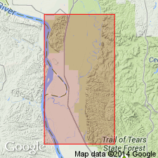
Named the Grassy Knob chert for Grassy Knob, 3.5 mi southeast of Grand Tower, Jackson Co., southwestern IL. Consists of more than 125 ft of chert in irregular rough layers 6 to 30 in. thick, with many cavities containing poorly preserved fossils, overlain by 12 to 15 ft of hard, siliceous and sandy limestone in layers 3 to 8 in. thick grading downward into bands of chert containing particles of glauconite. Total thickness is 150 ft or more. Unconformably overlies Bailey limestone and conformably underlies Little Saline limestone or unconformably underlies Clear Creek chert. The Grassy Knob is of Early Devonian age.
Source: GNU records (USGS DDS-6; Reston GNULEX).
- Usage in publication:
-
- Grassy Knob Chert
- Modifications:
-
- Overview
- AAPG geologic province:
-
- Illinois basin
Summary:
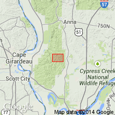
Lower Devonian Grassy Knob Chert overlies the Bailey Limestone and consists almost completely of chert. Thickness in the study area is about 200 ft and about 300 ft in the subsurface to the east. Massive chert beds exposed in the roadcut on the county road 3.8 km west of Tamms are probably in the middle part of the Grassy Knob Chert. Underlies Clear Creek Chert.
Source: GNU records (USGS DDS-6; Reston GNULEX).

- Usage in publication:
-
- Grassy Knob Chert*
- Modifications:
-
- Overview
- AAPG geologic province:
-
- Illinois basin
Summary:
Grassy Knob Chert mapped in IL. Consists of yellowish-white, thick to thinly bedded, very poorly fossiliferous chert. Grades into underlying Bailey Limestone. Age is Early Devonian.
Source: GNU records (USGS DDS-6; Reston GNULEX).
For more information, please contact Nancy Stamm, Geologic Names Committee Secretary.
Asterisk (*) indicates published by U.S. Geological Survey authors.
"No current usage" (†) implies that a name has been abandoned or has fallen into disuse. Former usage and, if known, replacement name given in parentheses ( ).
Slash (/) indicates name conflicts with nomenclatural guidelines (CSN, 1933; ACSN, 1961, 1970; NACSN, 1983, 2005, 2021). May be explained within brackets ([ ]).