

- Usage in publication:
-
- Grassy Flat member
- Modifications:
-
- Named
- Dominant lithology:
-
- Dolomite
- Sandstone
- Limestone
- Shale
- Breccia
- AAPG geologic province:
-
- Wasatch uplift
Summary:
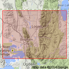
Named as upper member of Water Canyon formation for exposures in spur that separates Grassy Flat Canyon from Logan Canyon, sec no 4, in NW1/4 sec 32, T12N, R2E, Cache Co, UT on the Wasatch uplift. No type locality designated. Distinguished from underlying Card member (new) of Water Canyon by increase in grain size of clastic components and weaker gentler slopes. Composed of white-weathering dolostone interlayered with sandstone, arenaceous dolostone, limestone, and shale. Sandstone and sandy dolostone intraformational breccia occur near top. Is 355 ft thick in NW1/4 sec 32, T12N, R2E, Logan Canyon; is 527 ft thick in Coldwater Canyon, SW1/4 sec 22, T11N, R2W. Measured sections. Isopach map. Cross section. Underlies Hyrum member of Jefferson formation. Upper contact placed at top of intraformational, rounded, ledge-forming breccia of Grassy Flat with well-bedded limestone of Jefferson. Deposited in standing water; is probably of marine origin. Early Devonian age.
Source: GNU records (USGS DDS-6; Denver GNULEX).
- Usage in publication:
-
- Grassy Flat Member
- Modifications:
-
- Revised
- Areal extent
- AAPG geologic province:
-
- Great Basin province
Summary:
Revised in that Grassy Flat Member of Water Canyon Formation underlies the newly named Samaria Limestone Member of Jefferson Formation in sec 34, T15N, R4W, Box Elder Co, UT, thereby extending the name Grassy Flat into the Great Basin province. The upper contact represents a change from light-gray, medium-crystalline dolomite of the Grassy Flat to dark-gray, medium-crystalline dolomite with abundant gastropod shells. Devonian age.
Source: GNU records (USGS DDS-6; Denver GNULEX).
For more information, please contact Nancy Stamm, Geologic Names Committee Secretary.
Asterisk (*) indicates published by U.S. Geological Survey authors.
"No current usage" (†) implies that a name has been abandoned or has fallen into disuse. Former usage and, if known, replacement name given in parentheses ( ).
Slash (/) indicates name conflicts with nomenclatural guidelines (CSN, 1933; ACSN, 1961, 1970; NACSN, 1983, 2005, 2021). May be explained within brackets ([ ]).