The National Geologic Map Database is migrating to a new infrastructure. We apologize for any service disruptions during this process.
|
|---|


- Usage in publication:
-
- Grassy Creek Shale
- Modifications:
-
- Overview
- AAPG geologic province:
-
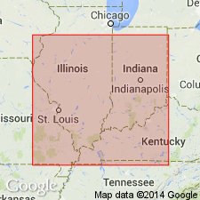
- Illinois basin
Summary:
In IL, Grassy Creek Shale was at first restricted to western part of the State, but Workman and Gillette (1956) extended it into central and southwestern IL in place of Mountain Glen Shale, a name long used in that area. Still later, it was extended into eastern IL by Collinson and others (1967) and North (1969). Grassy Creek appears in nearly all areas where Upper Devonian strata are present. Well exposed in Pike, Calhoun, and Jersey Cos. in western IL and in Union Co. and locally in Hardin Co. in southern IL. In subsurface, high resistivity in electric logs help differentiate it from Saverton Shale above and from Sweetland Creek Shale below.
Source: GNU records (USGS DDS-6; Reston GNULEX).
- Usage in publication:
-
- Grassy Creek Shale*
- Modifications:
-
- Revised
- Overview
- AAPG geologic province:
-
- Illinois basin
Summary:
Report discusses the New Albany Group of Late Devonian and Early Mississippian age, on the east side of the Hicks dome, Hardin Co., southern IL. Report uses terminology of Cluff and others (1981) with the exception that their New Albany Shale Group is revised to New Albany Group. The New Albany Group in this area includes the Grassy Creek Shale which in turn includes the Henryville and Falling Run Beds.
Source: GNU records (USGS DDS-6; Reston GNULEX).
- Usage in publication:
-
- Grassy Creek Shale, Member
- Modifications:
-
- Overview
- Areal extent
- AAPG geologic province:
-
- Illinois basin
Summary:
As defined by Collinson and Atherton (1975), includes the brownish-black shale interval of the middle and upper parts of the New Albany Shale Group in IL. Name is used in western and central IL. Unit has been extended to western KY as uppermost Member of the New Albany Shale. Unit contains thinly laminated, pyritic, organic-rich, brownish-to gray-black shale in western KY and southern IL, but northward in IL it grades into olive-black to olive-gray shale interbedded with grayish-olive- to grayish-green mudstone. Pyrite is common. The Henryville, Falling Run, and Jacobs Chapel Beds of IN have been identified in two exposures in southeastern IL and are assigned to the Grassy Creek. Elsewhere they are allocated to the undifferentiated Saverton and Hannibal Shales. The Grassy Creek reaches its maximum thickness of 160 ft in Hardin Co. IL and adjacent areas of KY. Unit thins eastward to 30 ft in west-central KY. In northern and western IL, it is undifferentiated from the Sweetland Creek. Conodonts from underlying Sweetland Creek and overlying Saverton Shale indicate an early Late Devonian age for the Grassy Creek of southeastern IL, which is probably equivalent to the Morgan Trail, Camp Run and Clegg Creek Member of IN. The Grassy Creek of western IL represents a smaller interval of time and is probably equivalent only to the lower part of the Clegg Creek and uppermost part of the Camp Run.
Source: GNU records (USGS DDS-6; Reston GNULEX).
For more information, please contact Nancy Stamm, Geologic Names Committee Secretary.
Asterisk (*) indicates published by U.S. Geological Survey authors.
"No current usage" (†) implies that a name has been abandoned or has fallen into disuse. Former usage and, if known, replacement name given in parentheses ( ).
Slash (/) indicates name conflicts with nomenclatural guidelines (CSN, 1933; ACSN, 1961, 1970; NACSN, 1983, 2005, 2021). May be explained within brackets ([ ]).