

- Usage in publication:
-
- Grapevine Wash Formation
- Modifications:
-
- First used
- Reference
- Dominant lithology:
-
- Conglomerate
- Sandstone
- AAPG geologic province:
-
- Great Basin province
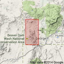
Summary:
First published use in Washington Co, UT, Great Basin province. Named by Wiley (1963) in unpublished thesis. No type locality designated; reference section designated near Grapevine Wash (from which unit probably named) in sec 36, T39S, R18W, northwestern Washington Co, UT. Occurs only in Gunlock quad (northwestern part of map area). Divided into 3 parts: 1) lower conglomerate member--pebble-cobble fanglomerate and sandstone near base; pebbles and cobbles of quartzite, chert, cherty limestone; forms cliffs; thickness ranges from 350-900 ft; 2) middle sandstone and conglomerate member--lithologically similar to lower member except has more sandstone and siltstone and is less resistant than upper or lower members; about 1,200 ft thick; and 3) upper red conglomerate member--poorly sorted polymictic conglomerate which includes boulders as much as 2 ft in diameter; most clasts are cobble or pebble sized, consisting of siltstone, sandstone, quartzite, and limestone; forms ledges and cliffs; thickness ranges from 300-400 ft. Grapevine Wash is as much as 2,000 ft thick in Gunlock quad. Unconformably underlies white sandstone and conglomerate member of Claron Formation or Oligocene volcanics. Conformably overlies Iron Springs Formation with gradational contact. Geologic map, stratigraphic chart. Tertiary?-Cretaceous? age based on stratigraphic position and by analogy with North Horn Formation of north-central UT.
Source: GNU records (USGS DDS-6; Denver GNULEX).
- Usage in publication:
-
- Grapevine Wash Formation*
- Modifications:
-
- Overview
- AAPG geologic province:
-
- Great Basin province
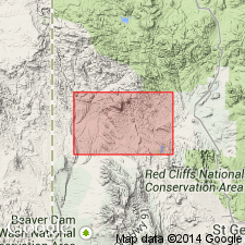
Summary:
Mapped in southwest UT, Great Basin province. Divided into lower conglomerate member, middle sandstone and conglomerate member, and upper conglomerate member (each mapped and described). Occurs only in Gunlock quad. Grapevine Wash represents a fanglomerate derived from rocks of the Square Top Mountain thrust sheet. Is as much as 600 m thick. Unconformably underlies Claron Formation. Overlies what is called a "tectonic mixture" which is interpreted to be a chaos of materials caught beneath Square Top Mountain thrust as it moved over exposed Triassic and Jurassic rocks in western part of Motoqua quad. Age is uncertain though based on its stratigraphic position and its tectonostratigraphic similarity to the North Horn Formation in north-central UT, Grapevine Wash is assigned a Cretaceous? and Tertiary? age.
Source: GNU records (USGS DDS-6; Denver GNULEX).
For more information, please contact Nancy Stamm, Geologic Names Committee Secretary.
Asterisk (*) indicates published by U.S. Geological Survey authors.
"No current usage" (†) implies that a name has been abandoned or has fallen into disuse. Former usage and, if known, replacement name given in parentheses ( ).
Slash (/) indicates name conflicts with nomenclatural guidelines (CSN, 1933; ACSN, 1961, 1970; NACSN, 1983, 2005, 2021). May be explained within brackets ([ ]).