- Usage in publication:
-
- Graniteville granite
- Modifications:
-
- Named
- Dominant lithology:
-
- Granite
- AAPG geologic province:
-
- Midcontinent region
Summary:
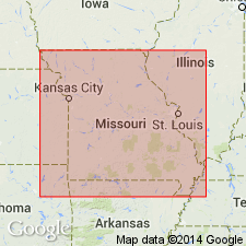
Named for exposures at Graniteville, Iron Co, MO, in the Midcontinent region. No type locality designated. Occurs near Cornwall, Madison Co, southwest of Coldwater, Madison Co, and near Van Buren, Carter Co, and within main granite area of Iron Mountain and Mine La Motte quads [locations not specified]. Unit is red, coarse-grained, prophyritic granite; in places is cut by basic dike. Unit was intruded before intrusion of gray granite in Ste. Genevieve Co and in Mine La Motte quad; intruded after intrusion of black felsite at Cornwall. Pre-Cambrian age.
Source: GNU records (USGS DDS-6; Denver GNULEX).
- Usage in publication:
-
- Graniteville granite
- Modifications:
-
- Revised
- AAPG geologic province:
-
- Midcontinent region
Summary:
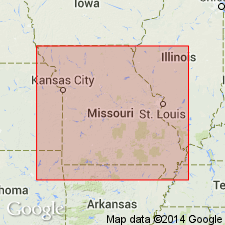
Pg. 49. Graniteville granite of Bevos group. Assigned to Bevos group. Is a medium- to coarse-grained, rich red colored granite. Porphyritic phases are common and erratic large feldspar porphyroblasts are found throughout the rock. In thin section, both orthoclase and microcline microperthite are abundant. Small, very irregular pegmatites are found at Heyward quarry. Is a central pluton that was intruded into a resurgent collapsed caldera. Formed during later phase (of 2) of batholithic intrusion. Appears to have differentiated in place. Correlates with Breadtray granite of Bevos group; Breadtray was last of batholithic rocks of St. Francois Mountains to differentiate. Age is Precambrian.
Exposed within area of active granite quarrying at Graniteville, in secs. 10, 11, 14, and 15, T. 34 N., R. 3 E., St. Francois Mountains, Iron Co., southeastern MO.
See C.E. Robertson, 1995, Precambrian rocks, IN T.L. Thompson, Stratigraphic succession in Missouri (revised-1995), Missouri Division of Geology and Land Survey, 2nd series, v. 40 Revised, p. 5-14.
Source: Strat. succession in Missouri (Thompson, 1995, p. 12); GNU records (USGS DDS-6; Denver GNULEX).
- Usage in publication:
-
- Graniteville Granite
- Modifications:
-
- Geochronologic dating
- AAPG geologic province:
-
- Midcontinent region
Summary:
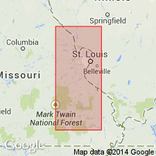
Rb-Sr age of 1280 +/-40 m.y. determined on whole rock/mineral separates; U-Pb age not determined. Rb-Sr ages on some rocks are consistently lower than U-Pb ages probably due to removal of Sr from rock. Age of most rocks studied is about 1500 m.y., but a real event as recorded by Rb-Sr occurred about 1300 m.y. ago. Samples are taken from St. Francois Mountains, southeast MO, Midcontinent region.
Source: GNU records (USGS DDS-6; Denver GNULEX).
- Usage in publication:
-
- Graniteville Granite
- Modifications:
-
- Geochronologic dating
- AAPG geologic province:
-
- Midcontinent region
Summary:
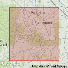
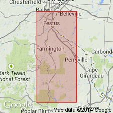
Rb-Sr data on whole rock samples yields an age of 1273 +/-92 m.y. Rb-Sr data probably underestimates actual age; low age probably due to Sr loss. Samples taken in T34N, R3E, Iron Co, MO, Midcontinent region (specific localities listed in appendix 3). Analytical data in appendix 4.
Source: GNU records (USGS DDS-6; Denver GNULEX).
- Usage in publication:
-
- Graniteville Granite
- Modifications:
-
- Geochronologic dating
- AAPG geologic province:
-
- Midcontinent region
Summary:
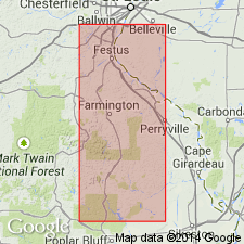
Whole rock Rb-Sr age of 1273 +/-92 m.y. on Graniteville in St. Francois Mountains, MO, Midcontinent region.
Source: GNU records (USGS DDS-6; Denver GNULEX).
- Usage in publication:
-
- Graniteville Granite
- Modifications:
-
- Revised
- AAPG geologic province:
-
- Midcontinent region
Summary:
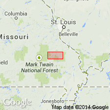
Graniteville Granite, one of seven Precambrian Y plutonic rock units assigned to the /St. Francois Mountains Intrusive Suite (revised). [Previously assigned to Bevos Group by Tolman and Robertson (1969); status of Bevos not discussed.] Present in St. Francois Mountains, southeast Missouri (Midcontinent region). Youngest plutonic rocks in the area; younger than "Silvermine-Knoblick Granites" (revised) of St. Francois Mountains. Age is Precambrian Y. Nomenclature listed in table 1.
[Conflicts with nomenclature guidelines (ACSN, 1970; NACSN, 1983, 2005, 2021): name St. Francois Mountains applied concurrently to two different units in same area.]
Source: Modified from GNU records (USGS DDS-6; Denver GNULEX).
- Usage in publication:
-
- Graniteville granite
- Modifications:
-
- Overview
- AAPG geologic province:
-
- Midcontinent region
Summary:
Mapped in central St. Francois Mountains, southeast MO, Midcontinent region. [Not clear if authors intended stratigraphic units within study area to be formal or informal.] Small outcrops shown on geologic map west and southwest of Middlebrook (near Graniteville), Iron Co, MO. Drillhole data indicate that unit underlies much of Bellview Valley to west where Graniteville is covered by Paleozoic sedimentary rocks. Graniteville is one of major plutons of area. Unit is similar to Butler Hill granite in its major element chemistry and petrographic characteristics; both are high silica granites. Microcline perthite in Graniteville is only real petrographic difference between it and Butler Hill in which perthite does not show microcline twinning. Shown on map explanation to be older than diabase dikes and gabbroic sills; younger than hypabyssal intrusive rocks (Munger Granite Porphyry and Carver Creek Granite of Tolman and Robertson, 1969). Everywhere that contacts are observed, plutonic rocks are younger than, and intrude, volcanic rocks of St. Francois Mountains. Proterozoic age.
[Authors' intentions are unclear as to which, if any, of the geologic units discussed should have formal status.]
Source: GNU records (USGS DDS-6; Denver GNULEX).
For more information, please contact Nancy Stamm, Geologic Names Committee Secretary.
Asterisk (*) indicates published by U.S. Geological Survey authors.
"No current usage" (†) implies that a name has been abandoned or has fallen into disuse. Former usage and, if known, replacement name given in parentheses ( ).
Slash (/) indicates name conflicts with nomenclatural guidelines (CSN, 1933; ACSN, 1961, 1970; NACSN, 1983, 2005, 2021). May be explained within brackets ([ ]).

